Sunday, September 18, 2016
Saturday, September 17, 2016
The new bridge on the Metacomet inspired me to see if the route all the way to the quarry north of Route 57 was still in my memory (or marked). All went well, and I was able to get around the quarry easily enough before heading back. Round Trip of 10.9-miles.
Looking East at beginning of Bog Bridge.
Halfway across.
A look North from mid-point of bridge.
East-Side of Bridge on the way back.
Friday, September 16, 2016
Took a very quick run on the Metacomet (or New England Trail, as it is more currently named) from Rising Corner into Agawam. Had a really nice surprise as The Pioneer Valley Hiking Club seems to have finished the bridge work over the swamp. It is amazing, and very well done.
Thursday, September 15, 2016
Another trip to Dubuque State Forest in Hawley, Massachusetts for trail monitoring and research. Focus for this trip was the Gould Trail, from South Road to Gould Meadow at Hallockville Road, and the connecting routes off the main section of trail. My monitor report records the following:
- Gould Trail, or Gould Meadow Trail, from South Road (0.20-Miles west of intersection of South & Middle Roads) to Hallockville Road directly across from Moody Spring Road. 1.36-Miles.
- Gould Horseshoe Loop, east and west, which completes a half-circle route intersecting the northern section of the Gould Trail, entering and exiting along Hallockville Road. West Section is 0.52-Miles; East Section is 0.39-Miles.
- The Gould Trail to Middle Road Connector, which begins 0.10-Miles north of the Gould Trail's southern trailhead off South Road and heads northeast. 0.40-Miles.
Abundant Stonewalls in area, and several cellar holes worth researching.
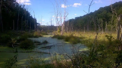
Bog off Hallockville Road.
Mushroom and Birch.
Cellar Hole.
Another Cellar Hole.
Wednesday, September 14, 2016
Tuesday, September 13, 2016
On this day in 2005, I completed my 29th marathon at Mt Washington State Forest, with the Riga Plateau, Appalachian Trail, and South Taconic Trail thrown in for good measure. I had Tippi and Wuzzam along for the day, which set a record for high temperature unfortunately for us. This was Tippi's 5th completed marathon.
Our time was 5:10:41, which shows we were really running pretty hard. The lack of water on the trail was a real concern for me, with Tippi. Luckily, the stream at the bottom of Bear had plenty, and from there on we were set.
Wuzzam looked absolutely beat climbing and coming down off Bear. He needed the stream to cool off in as much as Tips did.
Sunday, September 11, 2016
Saturday, September 10, 2016
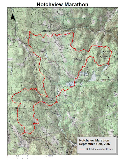
On this day in 2007, Tippi and I finished the Notchview Marathon. We ran from Notchview Reservation in Windsor, Massachusetts into Dubuque State Forest in Hawley, then to Savoy Mountain State Forest in Savoy. I remember that we got crushed by a heavy rainstorm for the last 3-miles.
This was my 35th completed marathon, and Tippi's 11th. All in all, I recall not being in fantastic shape but the year was winding down, and the run was incredibly enjoyable. I also recall missing a turn shortly after Windsor Jambs, continuing on the dirt road for a bit.
Looking at the map, we passed Windsor Pond, Crooked Neck Pond, and Hallockville Pond along the journey.
Meadow at Notchview
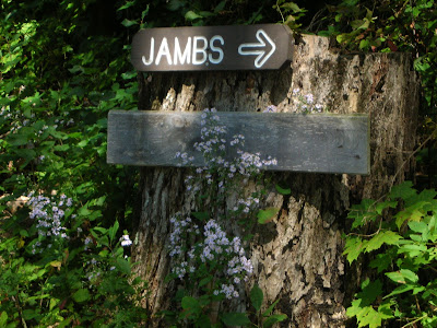
Tippi on the Jambs Trail.
Windsor Jambs.
Alert, as always.
Jambs, with Tippi on the ledge, upper right,
Friday, September 9, 2016
Wednesday, September 7, 2016
Two old marathons completed on this day, the first in 2008 and the second in 2014.
In 2008, Curly's Marathon was held in Pittsfield State Forest, and it was a beautiful day to run. I recall wearing old shoes rather than a new pair I had just purchased, and it was a bad decision. The pain in my feet and lower legs was incredible for the last 6 or 8 miles, and I was lucky to finish in 5:54:36. This was my 38th completed marathon. My dad ran the Half-Marathon option as well.
In 2014, Wuzzam and I conquered Dunbar-Whitcomb-Jambs in 6:21:34. This expanded from an old run the Bandit and I did, from Whitcomb Summit to Windsor Jambs. This time, we began at Dunbar Brook in Monroe State Forest, and ventured out a new snowmobile trail to the windmills to Whitcomb Summit, over Crum Hill, over Flat Rock Hill and the old Viewing Platform for the Hoosac Tunnel, crossed the Cold River on an obscure grown in path, past Savoy Mountain State Forest at North Pond, past Bog Pond, over Lewis Hill and Borden Mountain, through Windsor Bush into Windsor State Forest and the Jambs. Outstanding day with outstanding sunny weather. This was my 52nd completed marathon.
Unfortunate Windmill site.
The Elk Monument at Whitcomb Summitt.
Viewing Platform for the Hoosac Tunnel construction.
View from Flat Rock Hill with Greylock in view.
Crossing of the Cold River.
Stone Carving on rock, obscure path.
Bog Pond.
The Dunham Lot, off Tannery Road.
We are getting close!
The Jambs!
Dwarf Forest and the softest ground-cover imaginable.
Monday, September 5, 2016
Made another trip to detail the "Goathead" trail in Hawley. The out-and-back run was very enjoyable, especially experiencing the trail in both directions.
Some things noticed that lead to additional research were:
- The swampy marsh area at the height of land, which is the headwaters of the Swift River.
- The stonewalls crossed throughout the route are all the same wall; there is a fantastic network of stonewall in this area.
Sugar Maple along the way.
Stonewall Crossing.
Goathead Rock.
More Stonewall.
Sunday, September 4, 2016
Saturday, September 3, 2016
K2 and I visited Tunxis, this time running from Old Route 20 to Pine Mountain Road and back via the shortcut. Good for around 10k.
I witnessed a large porcupine early on rambling across the trail. Roberts Brook was running but barely... continues to be very dry in the northeast.
Took the short cut on the way back, just after the Roberts Brook crossing. There appears to be additional paths leading off this old route, which I have not seen before.
My porcupine pictures ended up too blurry due to low light and my hurrying. The rock is above the ravine prior to Roberts Brook; its right on the trail and you can not miss it.
Friday, September 2, 2016
Took a drive to North Adams to settle up some family business, and on the way home I made a stop in Goshen to the D.A.R. State Forest for a short run. I had a goal of hopefully capturing a few photographs of DAR's Balanced Rock.
I had enough time to take a few shots of the Balanced Rock, and the line of large stone that exposed itself along the surface very close-by to the Rock. Last photo is of a smaller perched stone that sits up top along the Turkey Trail. This one can be missed during spring and summer, but with leaves off it is pretty noticeable.
Subscribe to:
Comments (Atom)


