Wednesday, January 31, 2018
Tuesday, January 30, 2018
I decided to track my "peaks", or at least "high points" along the trails I cover. During January I can't say I overwhelmed climbing hills or mountains. One reason was the icy conditions for a bit of the month, another being the lack of available sunshine during the work week. Regardless, I did hit a few, as listed below:
- "Nick's Hill", West Suffield Mountain / Metacomet Ridge
- Bald Mountain, Shenipsit State Forest
- The Pinnacle, Shenipsit State Forest
- "Balanced Rock Hill", Shenipsit State Forest
- "Bent Birch Hill", Shenipsit State Forest
Monday, January 29, 2018
Sunday, January 28, 2018


Saturday, January 27, 2018
Wuzzam and K2 joined me on a ramble at Shenipsit State Forest. Temperature was going to be in the mid-forties, which is really awesome for the end of January.
Our plan was to run for 3-hours, and get a better understanding of the section north of the Pinnacle near Gillette Brook. The hope was to find more of a "path" and less of the bushwhack/grown-in-trail from last week.
Way back when, in 1999 & 2000 I believe, we did Simon's "Lost in Hampden" run from Hampden, Massachusetts to Bald Mountain in Somers, Connecticut and back. A portion of the route took us from Camp Ayapo/Hurd's Lake/Perkins Mountain over Gillette Brook on our way to the Pinnacle and the turn-a-round point at Bald Mountain. Once crossed the road at Camp Ayapo, we had to scramble through briars and blow-downs before finally picking up a trail half-way up the hill to Pinnacle. Today, we found a really nice option that exists in these woods just east of Camp Road at the Stevenson Woodlands.
As for Simon's, he also put on a regular Wednesday night 7-miler along the Skyline Trail (Northern Connecticut Land Trust), with an extension to Minnechoag Mountain, Hill 880', Pine and Rattlesnack. Several of us routinely ran this weekly, and it was pretty awesome. Development may have interrupted the section over 880', Pine, and Rattlesnake... I should explore again someday.
Back to today, we ended with 10.8-miles of sunshine running, and we found our way round. Wonderful day!
Climbing Balanced Rock Hill, with it's namesake

A view west from the Balanced Rock

Another view west from Balanced Rock, with Bald Mtn in the background

Wuzzam at the top of Bent Birch Hill

Trilogy of "carved stones" leading up from the "Bottoms"

Wuzzam at the "Twin Birch" four-way

Stevenson Woodlands, at Mountain Road

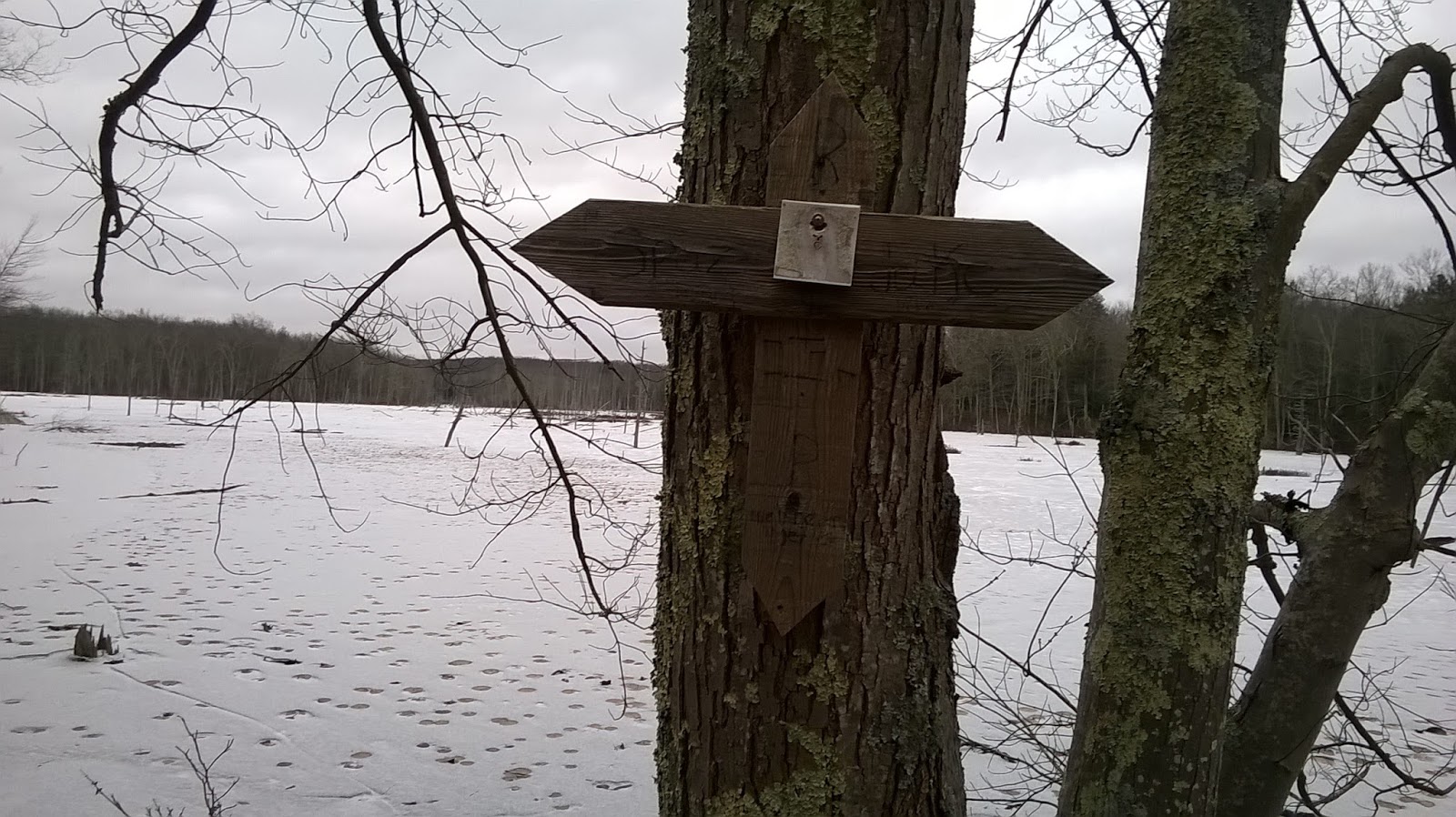
At the Pinnacle; the Shenipsit Trail once existed over this ridge!

Wuzzam at the old Shenipsit Trail marker on Pinnacle

Wuzzam at the top of Bald Mountain

Another "Notch" in the woods!


Friday, January 26, 2018

Thursday, January 25, 2018
Thought I'd add a little to the DAR GeoDatabase. Since a part of the forest is outside of Goshen, and resides in Ashfield and Williamsburg, this next image includes neighboring towns and associated road, stream, lake and elevation layers.
Conway and Cummington are also included, as I believe once I start adding trails to the geodatabase, there will be continuation into those towns as well.

Wednesday, January 24, 2018
Tuesday, January 23, 2018
Getting back to my DAR GeoDatabase, I've added the following layers...

- Elevation
- Rivers/Streams
- Lakes/Ponds
- Roads
The area of DAR State Forest is shown with darker contour elevation lines compared to the rest of the Town of Goshen. As can be seen, some of DAR State Forest resides in Ashfield, Massachusetts.

Monday, January 22, 2018
Sunday, January 21, 2018
Out to Galbreath Road to run over Bald and Pinnacle with Wuzzam. We followed a side trail we hadn't done before to the west of Pinnacle, following the path and bushwhack down to Gillettes Brook.
At this point, we bushwhacked a bit more trying to remember the Simon's Run we used to do in the late '90's. We connected with a good path that brought us up the four-way just north of Pinnacle, which we named "Twin Birch" intersection due to a nice white birch on the east branch.
Stuck to a few paths we were familiar with, and some we weren't. Ended the day with a nice 7.6-miles of enjoyable running.
Dam upstream of private bridge on Gillette Brook

Tall Stonewall north of the Pinnacle

Twin Birch

Wuzzam pointing to a balanced / perched boulder east of the Pinnacle

Soapstone's Notch

Wuzzam at the Monolith / Standing Stone


Saturday, January 20, 2018
Friday, January 19, 2018
Thursday, January 18, 2018
Martin Luther King Jr eastern Connecticut adventure Part III...
On the way home from Mashamoquet Monday, I also stopped off to see Frog Rock, and noticed several Roadside Memorials.


On the way home from Mashamoquet Monday, I also stopped off to see Frog Rock, and noticed several Roadside Memorials.
Frog Rock along Route 44, Eastford (I think)

Frog Rock along Route 44, Eastford (I think)

Roadside Memorial along Route 44, near Swamp

Roadside Memorial along Route 44, near Swamp

Roadside Memorial along Route 44, near Swamp
Roadside Memorial along Route 44, near Swamp

Mile Marker

Roadside Memorial, not sure if on Rt 44 or Rt 74

Wednesday, January 17, 2018
Another from the "Twenty-Years Ago Today" department....
Well, despite Wuzzam insisting that we would “find that lost mountain”, Mt. Riga would have to wait for the ice to leave before any of us ventured out that way to search. Instead, a quick call to Farmer Tom in Ashfield put us in the direction of Hawley for the second time in two weeks. There was plenty of fresh light fluffy snow within its confines!
LACK OF LOST MOUNTAIN
Well, despite Wuzzam insisting that we would “find that lost mountain”, Mt. Riga would have to wait for the ice to leave before any of us ventured out that way to search. Instead, a quick call to Farmer Tom in Ashfield put us in the direction of Hawley for the second time in two weeks. There was plenty of fresh light fluffy snow within its confines!
We ended up breaking trail no matter where we went, and the conditions
were as perfect as one could hope for. Our stop at Moody Spring had us
in tears (due to laughter) as Wuzzam rambled on and on about how he had
imagined it to be a huge tourist attraction with signs and all. The pipe
shooting out of the stone with the tasty mineral filled water exiting
it wasn’t exactly what he had expected, but he did admit to its power of
“regeneration”. When I let him know that it took me 9 years to find the
thing, he could understand why. Up until last February when the Old
Goat, Uphill and I finally made it to the water, it was “Lost Spring”
along with “Lost Mountain” we were searching for.
Several of the trails we explored are not on maps, and are not exactly
“trails” either. Blasting down the slope to Moody Spring had someone
mentioning that it “wasn’t much of a trail”, to which Karl laughed and
said “who needs a trail??” That about sums it up for snowshoeing... you
really don’t need a trail, just snow.
MOODY SPRINGS SNOWSHOE RAMBLE II
JANUARY 17, 1998 HAWLEY, MA
JANUARY 17, 1998 HAWLEY, MA
Keen-Eye 20km 3:21:00
Old Goat 20km 3:22:00
Bandit 20km 3:23:00
Wuzzam 20km 3:24:00
Farmer 20km 3:25:00
Tuesday, January 16, 2018
Part II from my Martin Luther King Jr day in eastern Connecticut...
When I brought Wuzzam to the Goshen Chamber back on November 10th, he got really excited and mentioned that there was a similar structure in Thompson, Connecticut, that he had seen years ago. The Woods Walker also has mentioned this site to me, letting me know that it was worth visiting.
Wuzzam and I figured that after jogging in Mashamoquet, we would leave a car at his condo, grab our buddy Sammy, and head over to the Airline Trail State Park for a 0.6-mile walk to see the chamber. It was definitively worth a visit!

Thompson, CT Stone Chamber

Thompson, CT Stone Chamber

Thompson, CT Stone Chamber

Wuzzam & Sammy at the Thompson, CT Stone Chamber

From Inside Thompson, CT Stone Chamber

From Inside Thompson, CT Stone Chamber

Thompson, CT Stone Chamber

Thompson, CT Stone Chamber

 Pop and Paul, with Moose scat
 Paul and Pop at High Bridge
 Greylock in the background, heading away from High Bridge


And, from the wayback machine... 15-years ago today, January 16th, 2003 the Hoosic Range
Tippi with all four feet off the ground!


Monday, January 15, 2018
Enjoy and Reflect a bit for Martin Luther King Jr Day!

Table Rock, Mashamoquet Brook State Park


Balanced / Perched Rock, Mashamoquet Brook State Park
 Balanced / Perched Rock, Mashamoquet Brook State Park

Balanced / Perched Rock, Mashamoquet Brook State Park

Flat Rock at Mashamoquet Brook, Mashamoquet Brook State Park
 Flat Rock at Mashamoquet Brook, Mashamoquet Brook State Park
 Mashamoquet Brook, Mashamoquet Brook State Park

DEEP Map

Another Goal I have for 2018 is to visit forest in Connecticut I have not been to, and enjoy what these new (for me) spots have to offer. Today, I drove towards Wuzzam's neighborhood, as he has wanted to introduce me to Mashamoquet Brook State Park in Pomfret, Connecticut.
Mashamoquet is home to Table Rock, Wolf Den, and Indian Chair. We spotted some other outstanding stone structures as well over our 4.8-mile jog.

Table Rock, Mashamoquet Brook State Park

Table Rock, Mashamoquet Brook State Park

Table Rock, Mashamoquet Brook State Park

Wolf Den, Mashamoquet Brook State Park

Wolf Den, Mashamoquet Brook State Park

Wolf Den, Mashamoquet Brook State Park

Indian Chair, Mashamoquet Brook State Park

Indian Chair, Mashamoquet Brook State Park

Indian Chair, Mashamoquet Brook State Park

Indian Chair, Mashamoquet Brook State Park

Balanced / Perched Rock, Mashamoquet Brook State Park


Balanced / Perched Rock, Mashamoquet Brook State Park


DEEP Map

Subscribe to:
Posts (Atom)