Wednesday, February 28, 2018

Continuing to track my "peaks", or at least "high points" along the trails I cover.  February looks a bit better than January.

February's High Points:

  • Skyline Overlook, Somers, CT
  • Goat Rock and Lookout Point, Hampden, MA
  • Minnechoag Mountain, Hampden, CT
  • "Nick's Hill", West Suffield Mountain / Metacomet Ridge, Suffield, CT
  • Hill 880', Hampden, MA
  • Pine Mountain, Hampden, MA
  • Perkins Mountain, Somers, CT
  • West Ridge, DAR State Forest, Goshen, MA
  • Walnut Hill, Williamsburg, MA
  • Copper - Peak Mountain, Metacomet Trail, Granby, CT
  • West Suffield Mountain, Metacomet Trail, Suffield, CT
  • Merritts Hill, Williamsburg, MA
January's High Points:
  • "Nick's Hill", West Suffield Mountain / Metacomet Ridge
  • Bald Mountain, Shenipsit State Forest
  • The Pinnacle, Shenipsit State Forest
  • "Balanced Rock Hill",  Shenipsit State Forest
  • "Bent Birch Hill", Shenipsit State Forest
And, from old gps data, it looks as though Tippi and I were on a Hawley Notch snowshoe this day (February 28th, 2008) ten-years ago.


Tuesday, February 27, 2018

Here is the flyer for my friend the Woods Walker's presentation this evening.  I assisted with the slides/images for the third time on this year's Rock Show Tour.

Again, like the prior two presentations, a full crowd of very interested people, both young and old.  It appears people are hungry for all things nature oriented.


And, from old gps data, it looks as though Tippi and I explored the Dubuque State Forest in Hawley, from Middle Road to East Hawley Road, this day (February 27th, 2008) ten-years ago.


Monday, February 26, 2018

Back out to Skyline Scenic Area in Somers, CT to wrap up the segment from South Road back up to the Skyline Trail.  Spoke with Kevin S to get my bearings, as it "looked" different last Friday when I didn't make the connection.

Found my way relatively easily, saw a few options and remembered the old "correct" route.  It was much more traveled and wide-open today verse when we ran here regularly in the early 2000's.

Totaled up 4-miles in sun and forties temperature. Not a bad Monday for February!

Large Boulder on the Skyline Trail

Another view of the Boulder

Old forest road with small stonewall over stream and rock bed

View west of Skyline's Peak


Sunday, February 25, 2018

We are still stuck in a rainy pattern for weather;  I waited until 4:00 p.m. when the rain was due to finally leave.  Managed 3.8-miles along Main Street.

And, 15-years ago today, February 25th, 2003, Tips & I visited Dubuque State Forest in Hawley...


Tippi Crossing the Brook along Sprague Road 


And, from old gps data, it looks as though Tippi and I explored Cummington and Plainfield snowmobile trails on this day (February 25th, 2008) ten-years ago.


Saturday, February 24, 2018

An afternoon drive to Williamsburg to see if I could find the route from the Bradley Sanctuary to the Tilton Farm Trail area at DAR State Forest.  A part of this was the old snowmobile corridor, which I last visited on May 29th, 2012.  

Bradley Sanctuary looks well maintained and in great shape.  The connector from Bradley around Nichols Swamp went well, but the old woods road past the gravel pit and old cemetery (which I've never seen) was a true mess due to logging.  I ended up bushwhacking until I found another old woods road, and exited on Brier Hill Road instead of Wing Hill Road, about 8/10 off.

I needed to be a little lower on the ridge, close to Rogers Brook.  I'll venture out again to run from the north and head south.  The biggest issue is the heavy logging, which has always been present, but right now is brutal.  I feel confident I can connect the pieces, and I also will head east from Bradley toward Conway State Forest.

Heading back, I noticed a large stonewall toward the top of Merritts Hill, so I ended up bushwhacking again through a mess of downed trees and stumps.  I finally emerged on a woods road, which looked like it was heavily used for the logging operation.  Ended up with 5.7-miles, and I just beat the rain!

Bradley Sanctuary Kiosk

Inscribed rock for the Bradley Property

Bradley Sanctuary's Large Oak just beyond the stonewall

Nichols Brook

Nichols Brook and Ravine


Friday, February 23, 2018

Back to Hampden and a bit more "attempt" at piecing together the Old Simon's Run.  Weather was bad, 40-degrees and pretty heavy rain during the drive to South Road.  Once I arrived, the rain sort of stopped, and I was on my way.

I parked adjacent to where we would exit onto South Road at the most southern point...  the trail still looked like it was being used by motorbikes at least occasionally.  I followed through the mud, brier, and water further than I thought I should have, and came upon a busy intersection and a house up on the western most portion of a hill.  I stuck with the northern route, placing the southern option in my memory bank for another day,

This intersection was the climb up to Pine Mountain, and it did not look familiar to me until I was at the top.  Truthfully, we always navigated this course in the opposite direction of what I was doing today, and it has been about 20-years since I was on it.  I guess this explains my lack of noticing.

So, the good news is the other option at the base of this climb should bring me to Rattlesnake, or in the general vicinity.  That gets me across from the Camp Ayapo trails from yesterday's run.

Sticking north, I dropped off Pine, and from the top down the north-side it was totally familiar.  I thought about the Wednesday night run long ago in a tremendous Thunder and Lightning storm, with huge chunks of hail tormenting us and lightning crashing right around the group.  God Bless Tippi for hanging in with me during that night.

Up 880, which I remembered well, but down the north-side seemed a little different.  Toward the bottom it was really different, and I have to also admit that we always ran this in the summer with leaf on the trees.  The forest was open and bare today.

Exited on South Road exactly where I had hoped to, across from the power-lines heading up the Minnechoag Mountain Trails.  The old Simon's Route is really coming together.

Once back at the car, I headed a bit more south on  the road to see if I could spot the re-entry into the woods to join the Skyline Trail, but it began to rain hard again and I called it a day with a little over 5-miles total.  A wonderful, rewarding day.

On the top of 880, looking at Pine Mountain to the south

Foundation along South Road


Thursday, February 22, 2018

Drove out to the old Camp Ayapo in Somers, Connecticut today.  This is a piece of the "middle" missing from the old "Simon's Lost in Hampden" adventures.

Back on January 27th, Wuzzam and I arrived opposite the old camp at the trail-head for the Stevenson Woodlot.  Then, in early February, the 1st & 2nd actually, I had explored the Skyline Area and Minnechoag Mountain area as well.  The Hill 880', Pine, Rattlesnack, Perkins and Ayapo are what remained for exploring.

So today, it was to the easiest missing spot;  Somers Open Space has been improving the trails around Ayapo for a few years now.  It was really enjoyable to see the hard work placed into this wonderful area.

Back in the 1990's, DL and I fished Hurd's Lake several times a week, in our Old Town Canoe with our spaniel Dusty always in the boat as well.  We spent several years in that water.

Then, for a couple years in the early 2000's,  JC would attended summer camp at Ayapo.  I would drive out most Friday afternoon's with Tippi to pick him up.  

This spot really holds some wonderful memories for me, and today only helped further cement them in.  Ended up with 3.8-miles after a light snowfall.

New signage with an accurate map!

 Looking back across Hurd's Lake from the north


Twenty-years ago today, February 22nd, 1998, I directed the second WMAC Snowshoe Series Race at Dubuque State Forest in Hawley, Massachusetts.

1st Annual Hawley Kiln Klassic 7-Mile Snowshoe Race
February 22nd, 1998 - Hawley,  Massachusetts

The event had 8 starters and finishers, including Old Farmer Tom who tried to snowshoe and mountain bike through the course.  We wrapped up an awesome first ever weekend of snowshoe racing, and were on our way!

Wednesday, February 21, 2018

Twenty-years ago today, February 21st, 1998, I directed the first WMAC Snowshoe Series Race at Savoy Mountain State Forest...

1st Annual South Pond Shuffle 4-Mile Snowshoe Race
February 21st, 1998 - Florida & Savoy,  Massachusetts

The event had 36 starters and finishers, and circled North Pond, South Pond, and Tyler Swamp.  Our snowshoe series began during the 1995/1996 season, but this was the first actual "race".  

The series is still going strong in 2018, but I "retired" from organizing and directing after ~20-years in 2016.  When I look back, it was a huge portion of my life given to the series.  The many awesome memories, friends, and laughs made it really special.  I'll never forget the fun snowshoeing provided.

Tuesday, February 20, 2018

Music 2018...

Effort #8, Cast a Shadow.  Originally written and performed by Beat Happening.

Monday, February 19, 2018

Presidents Day today, drove out to Williamsburg/Goshen to connect the snowmobile trail from Route 9 at the Breckenridge Property to above the solar panel field.  Finished with 4.9-miles on snowshoes.

Above the solar panels on Walnut Hill I watched a lone coyote scamper away through the snow, which was my first glimpse of a coyote in a few years.  While moving through the Breckenridge Property on the east side of Route 9, I witnessed a red-tailed hawk passing through the hemlock.

The day was a success as I completed  the connections I had hoped to;  an uninterrupted path from DAR State Forest to the Breckenridge Property and Old Goshen Road.  The next bit will be a southward 1/2-mile journey to join the Bradley Property, which used to get me to DAR or Conway State Forest via snowmobile corridor routes.  I plan to check the condition of those passes.

Blake Brook east of Walnut Hill

Interesting stonewall running into a large boulder on Walnut Hill

Perched Rock on Walnut Hill

Another view of the Perched Rock on Walnut Hill

Blake Brook in the Breckenridge Property

Bridge over Blake Brook in Breckenridge

Trailhead Signage on Old Goshen Road


From the Archives...  On this day in 1995, the 1st Moby Dick Marathons were held.  This was my 5th marathon, with the 28-miles completed in 5:01:00.

It seemed like a good idea, but there are reasons why the event didn't last, especially as a 28 or 30 miler.  Bitter cold, difficult, no aid,  February on Greylock....  seems like there would be many additional "whys".

This run was really special for me, it cemented my friendship with Paul.  We ran the entire event together, and began to dream up our snowshoe series.  Paul and I ended up roaming the woods together for a very long time, we see the same things in nature.


Sunday, February 18, 2018

Resting today due to cold/flu symptoms.  Here is a real oldie...

From the Archives...

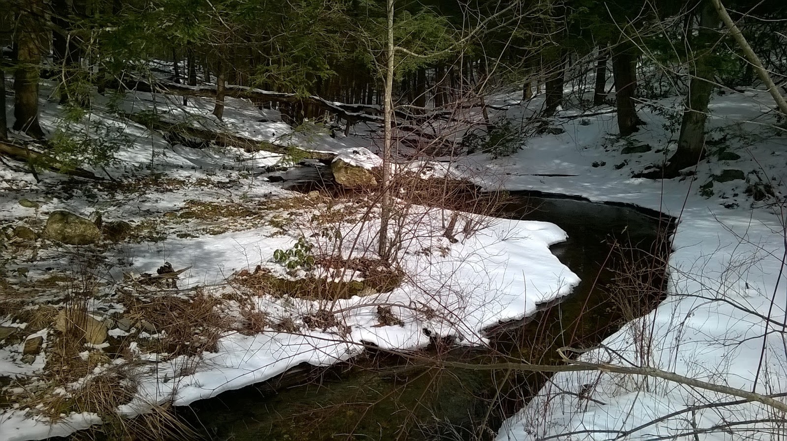
On this day in 1996 I completed my 9th marathon, the 2nd Annual Moby Dick.  It was a run on snow, and Georgie Hendricks and I wore snowshoes.  The event began at the Greylock Visitor Center in Lanseboro, Massachusetts, and ran up the snow covered road to the summit of Mt. Greylock, then down to North Adams, and back.  Covered the 28-mile version in 6:16:43.  


Here is my old friend's recollection....

ODE TO REAL COLD MEN

So I thought I had seen and done it all vis a vis running in strange places for insanely long distances.  Then the farmer called to remind me of Mount Greylock and his plans to conquer the beast in sneakers.  I looked out the window that morning and groaned.  True dead of winter stuff here, folks.  Driving through northern Massachusetts I looked over at the grin on this guy’s face and knew I was in for it.  I mean he’s Fitzcarraldo, the windmill dude, Dr. Strangelove, all of the above when he gets this look in his eye.  I knew there’d be no stopping him on this quest.

We arrived at the visitor center around 9 in the morning and dodged obnoxious snowmobiles as we walked toward the hospitable lodge.  I sat on the couch and admired the pretty park ranger while Ed ran his hands over the diorama of the Mountain, mentally tuning his Zen state for that morning’s fun.  No kidding now.  This was really the last place on earth I wanted to be.  At least that’s how I felt when I saw that Ranger Sally had a wedding ring.  Then our fellow ghouls straggled in and I could see that this was a for real event.  So I disappeared into the bathroom to write some graffiti on the wall and hoped against hope that Ed would forget I had driven up with him.

SADDLE UP, EASY RIDER!  His voice shook the stall.  I fell off the seat.  Here we go again.  Fortunately the crew had left 5 minutes earlier in pansy ass sneakers.  We Bulls would be lashing Snowshoes for this trek.  Only problem was that I had never worn snow shoes.  It wasn’t a pretty sight.  The first 7 miles to the base of the summit were, however, quite beautiful.  Ed and I even managed to smoke Dion, Joe and the boys.  I should have relished the moment.  It’d be the only Moment that day.  Because Lord Greylock was readying some payback for the proud.

Leaving the protection of the trees below the summit was like getting hit in the chest with a sledge hammer.  Naturally, I wore my 1930’s issue wool hunting uniform and I was soaked in sweat.  50 mph gusts of arctic wind sift through those fibers and find your very white blood cells in no time.  I knew my number was up at the summit, mile 8.  Bob Dion joined us at the top, allowing me a chance to pullback from the duo a little while I waited for the downhill section.  So I waited and waited and waited.  Mile after mile after mile and the damn mountain wouldn’t go down.  Truly dispiriting.  So I did the old, walk, trot, jog, walk thing until I met up with Ed and Bob coming back up the turnaround.  They looked like Chechen Rebels home from a night at the front.

“You don’t want to go there.  Don’t do it,” they warned.  I would have gone, really would have done the upright thing, finished the steep section, real man and all that.  But they had good food.  I thenceforth trailed them like a beggar, picking up scraps they’d toss over their shoulder.  Believe me you lose your pride pretty quick out in no man’s land.  That’s why they call it no man’s land.

It was a mutually beneficial run from there.  Bob and Ed set the pace just ahead, providing me with a little motivation to put one weary foot in front of the other.  And I gave them that healthy fear of failure, of being passed by a highly competitive opponent breathing down your neck.  Yea right.

At the junction leading back to the summit, we stopped to discuss making the extra 3 mile run to the top and back.  I fiercely argued that we had to go the extra yardage and finish the quest or we couldn’t live with ourselves.  Ed said something about bad luck visiting a mountain top twice in a day. Bob kept looking down the hill with an insane smile on his face.  I decided that this crew really didn’t have the je ne sais crois necessary to reconquer Greylock so I took command and ordered my men down the mountain.  Of course I trailed at a good healthy distance in case either of them fell by the wayside.  A really good healthy distance.

Bob and Ed bounded down the hill like kids at the final bell.  I stayed behind and ran to the summit on my own.  And I did it extremely fast.  Extremely.  Extremely enough that I ended up finishing the race in about 7 hours.  The latter hour of which found me crawling on my hands and knees as women in thongs and fine tan lines whizzed by on flaming green and red snowmobiles.  I must have looked pretty scary because nobody stopped to pick me up.  By the time I hit the parking lot, Bob and Ed were fast asleep in their cars inhaling carbon monoxide.  I pulled off my socks in Ed’s truck and watched as my toenails came off in the process.  Seems the crusty buggers had snagged on my wet wool socks.  I hadn’t felt the pain because of the frostbite.

So here’s a healthy Bronx cheer to those of you who decided to opt out of the Greylock quest.  I’m going to say that you really missed out on the time of your lives, a unique opportunity to test your primal bounds, to run with the wolves, to gasp on the edge of being, to wake up around oh....  11:00 on a Sunday morning, lounge on the couch in the sunroom and browse through the paper, enjoy a piece, two pieces of cinnamon raisin toast, take a nap, take another nap, watch an old movie with a pint of ice cream and some cute thing.  Ahhhh heck.  So maybe I made all this up.  But maybe I didn’t.  If any of you get a mouthful of hair when some freak streaks by you this coming season, just look down at his mangled toes.  You’ll know where you should be next February.


Saturday, February 17, 2018

Planned to attempt the Metacomet Ridge from Route 20 to Phelps Road, a 10-mile out-and-back with K2 this morning.  Our thinking was to get out early enough so that the frozen, solid earth wouldn't turn to slippery mud as we motored our way along the spine.

We managed just fine, and the earth was just starting to warm enough to get slippery during our last 15 or so minutes on course, so no big deal and our timing was fine.

Miles 1 & 9, Copper/Peak Mountain with Talcott Mountain in the distance


Friday, February 16, 2018

Back toward DAR State Forest to tie up the snowmobile trail from the solar panels.  Took a chance and drove up Route 143, and found a great spot to park at the snowmobile crossing.  This looked familiar to what I remembered, having last been exploring on these trails back in the winters of 2007, 2008, and 2009 with Tippi.

The conditions were bad for snowshoeing, and even worse for running without them.  Intermittent snow cover, lots of slick ice, some mud and rocks.  Good news was that I was able to follow the route easily enough.  The trail ended up being pretty familiar, and right at the 2.5-mile mark from Route 143 I intersected my stop-point from last Saturday, at the top of the solar panels.  Turned around for a nice 5-miler for the day.

There were two intersections along the way that were "signed" as snowmobile route corridors, with directions to "Pat's Store" on Route 9.  Both of these will be explored in the future, with the northern most path most likely leading down to Route 9 opposite the Breckenridge Sanctuary.  

Today's 5-mile route

Solar Panels, today's turn-a-round point from the south

Headwaters of Town Lot Brook, a tributary of Meekin Brook

Overall Route from DAR to Route 143

Thursday, February 15, 2018

Dolmens and Standing Stones

6:30 PM - 7:30 PM
Granby Public Library - "Big" Room


I again assisted my friend the "Woods Walker" with his program at the Granby Public Library tonight.  It was a capacity crowd, with the majority of the attendees (easily 50 or more people) enthusiastically invested in the presentation / story telling.

I thought that the presentation went very well, with a very charged audience.  Up next is a night at the end of February at the Suffield Senior Center.


Wednesday, February 14, 2018

Dolmens and Standing Rocks, Evidence of Ancient Civilizations

at the Prosser Public Library, Bloomfield, Connecticut

Woods Walker, Part III... Prosser Public Library

Tuesday, February 13, 2018

Music 2018...

Effort #7, Heaven's Chalkboard.  An original from the Road Warrior's for Christ, 2018.

I was inspired by Rev King's "Preacher's Pulpit #2, and added a little guitar run to the Power of the Message:

Take an eraser to the long lists of sins that the devil has wrote on the chalk board of Heaven...
and your name's written in the Book of Life.
With this new life life comes new responsibilities.
We are not Saved just so we can go to Heaven, we are bought with a price and now we are not our own...  We Belong to the Lord! 


Monday, February 12, 2018

Fourth run in 2018 along the 7-mile Hill Street Loop;  Temperatures around 40-degrees and cloudy.  The woods would be just too wet, slippery, and messy to attempt after the all-day rain yesterday.

Sunday, February 11, 2018

Rain all day, varying between light and hard.  Waited until dark and it let up enough for me to run "dry" along Main Street for 3-miles.

Saturday, February 10, 2018

The weather report called for a warm, rainy day for the region.  K2 and I decided we would risk a drive to the Daughter's of American Revolution State Forest in Goshen, Massachusetts, and hopefully beat the moisture.

We were fortunate, the rain held off, and we managed 2:20 on our snowshoe'd feet.  I ended the route with 9.6-miles along the snowmobile corridor from the Headquarters at DAR to the solar field off Route 9.  Conditions were actually excellent, but as soon as three sleds passed me by with a mile to go, I could see the base was eroding fast.

The route hasn't changed from 2008 & 2009 when Tippi and I covered a huge chunk of this area over two winters.  At least to the point I turned around (the solar panel field, which obviously wasn't present ten-years ago).  I'll need to get back soon, to see if anything has changed, and build upon the "circled world".

Crossing over the West Branch of Rogers Brook

Interesting stonewall, and what is under the snow?

Surprise of the day, a Balanced Rock

A view from above the solar panels, my turn-a-round point

Another view of the Balanced Rock


Friday, February 9, 2018

I drove to Adams to see my parents today, which ended up as a wonderful visit.  It has been a while since I brought them donuts from Mrs. Murphy's (in Southwick), so that was my first order of business.

Around the half-way point, I stopped at DAR State Forest in Goshen, to get a short 3.4-mile snowshoe jog in.  Stuck to the roads as a snowmobile had thankfully broke trail (there was an inch crust on any unbroken snow, and snowshoers know how difficult it is to get any rhythm going in those conditions).  Saw the snowmobile take a turn east off Wing Hill Road up toward West Ridge, so I followed a nice loop up and down.

Enjoyed my time with my folks (and Otis), and while on the way back home I stopped at Angelina's in downtown Adams to bring a sandwich back for DL, and then one more stop at  Perkarski's in South Deerfield for some supplies.  

Old Cellar Hole along Wing Hill Road

Bent Tree Limb

Rogers Brook

Tilton Farm Sign

Meadow at Tilton Farm, Holyoke Range viewable in the "Notch"