Saturday, April 30, 2016

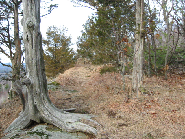
Mohawk Trail State Forest, Charlemont, Massachusetts.  One of my favorite spots, whether with others or alone.
 Stafford Meadow, August 2014, Mohawk Trail Adventure.

 Red Pine Plantation, circa 1930's.

Looking skyward from the Pine Plantation.
 

Another excellent adventure and learning experience with my friend Bob L.  His friend Ray was along, who I am getting to know also.  These two are really full of forest wisdom.  Ray is doing some amazing things with his camera, as evident here.  We also had Jared, from eastern Massachusetts, and Tuomas visiting from Finland.

We spent the day wandering, measuring, documenting and sharing in Mohawk Trail State Forest.  One of our first stops was to the Jake Swamp Pine the tallest tree in New England.

Jake Swamp Pine.
  
Jake Swamp Pine.
  
It was another valuable day for me, as my knowledge of this forest slowly increases through these trips and learning experiences.  I am a fortunate man.

Friday, April 29, 2016

Met up on a Friday afternoon with Wuzzam and the Old Goat, for a decently demanding 10k in Whitiker and McCann Farm Trails.

Grinded it out, decent climbing and beautiful trails in these woods.  A real gem, especially as you get deeper in off the parking areas.  Brooks, stonewalls, large pine, and top notch trail maintenance and design.  Great work Norther Connecticut Land Trust People!


Wednesday, April 27, 2016

On this day in 2006, I completed the Metacomet Marathon with my dog Tippi;  it was just us.  By 2005, most of my running turned toward exploring and mapping routes through the forest of Western Massachusetts and North Central Connecticut, with an emphasis on picking out ways to connect big tracks of land, and turn them into runs of marathon length.

Tips taking a look toward the quarry in West Suffield, Connecticut.

This run began in Sunrise Park, Suffeld, Connecticut and flowed south through Penwood State Forest in Bloomfield and Simsbury, Connecticut.  We spent 6:27:00 completing a little over 28-miles or so.  This was my 31st marathon completed, and Tippi's 7th.
 
Hueblin Tower in the distance; we would be turning around just prior to it.

Notes:  A great day;  started out 50 degrees at the 9:45 A.M. start time.  I believe it reached 70 degrees during the day, with most of it in the mid to upper 60’s.  Sunny and blue sky entire time, with a bit of a nice breeze every once and a while.

Tippi taking a look back off a ledge.

Much of the route is a ridge trail, with weather beaten trees still standing.

Tippi at the finish, ready to eat and rest.
  
 The Route we managed in April of 2006.

Sunday, April 24, 2016

With the first ten-miles (northern section) of our Shenipsit Marathon set, as well as the last seven-miles from Mountain Road into Whitiker Woods and McCann Farm, all that was left was a test run on the two middle sections.

First middle section is a short two-miles, between Route 190 and Gulf Road.  That leaves us with roughly seven or eight-miles for the "Soapstone" portion.

Interesting "balanced" or "perched" boulder along Parker Road. 
 

Today was a strong 12+ miles in 2:38:00.  That was good running for us, especially since we lost some time with the right off the Kibbe extension (turned too soon, but it worked out), and we did some loops after crossing Parker Road.  There are just so many trails in this forest...  and I don't mean that in a good way.

Wuzzam and Tedziou find "us" on the kiosk map.
 

The mileage worked out today;  the planned marathon run is at least twenty six-miles.  The maps are complete, and the trails are cemented in our heads.  Now, just a bit more "build-up" to get to where we can comfortably run for six to seven hours.

The route today...  handled fairly well.

Saturday, April 23, 2016

Enjoyed a quiet walk with my dog in Jesse Fowler Smith Memorial Forest, Suffield, Connecticut.  This is a close to home location with a nice short loop that is covered by massive beach and white pine trees.


The area is really underused, the few people I run into when hiking here live in the neighborhood.  It is basically flat, so Tippi can navigate it well. 


It's always good to get out in the woods with my dog.  Or anywhere, actually.

Friday, April 22, 2016

Solidifying the Sodom Road section.  From Galbreath Road parking, to the crossing at Gulf Road, is right around 2-miles.  Out and back today gave me 3.5-miles.  There are some interesting rock formations in this area...  my March 26th post had some stone mound photographs.  Today, I have one large boulder pic.

Large Boulder near Sodom Road.


Thursday, April 21, 2016

Today, I scouted Whitiker Woods and McCann Farm Trails.  This beautiful segment of forest will be the ending leg of our planned marathon.  I needed about 6-miles from the intersection south of Mountain Road, which is a bit northwest of Soapstone Mountain.  Using a a chunk of the Whitiker and McCann Trails gets it done.

Stone Wall along the way to Soapstone.


Our Marathon is coming together, everything but the Soapstone section.


Sunday, April 17, 2016

Another day in Shenipsit State Forest, doing the northern section of our planned spring marathon.  Today, 8.2-miles, hitting Bald and Pinnacle in the opposite direction of usual (for us).  I believe that to truly know a forest, or trails in a forest, you have to be able to see them in your mind.  That means learning them from all directions.

A nice perched rock along the route.


Saturday, April 16, 2016

A visit to Mohawk Trail State Forest, in Charlemont, Massachusetts, with my friend Bob, who knows every square inch of this forest.  I've been out a half-dozen times with Bob in Mohawk, and I am amazed at what I learn each visit.  Today, we had Jared joining us from Central Massachusetts.

I got to the forest early, and took a run from the Headquarters up the south side of Thumper Mountain.  This is a fairly new path that the staff has been opening up;  it is really awesome as it allows a loop over Thumper Mountain, rather than an out and back from the summit.  The other nice thing about the new route is the trail passes fairly close to the "Gateway".  I didn't have a camera with me, but will remedy that in the future.

Once back to the car, it was a short wait for Bob and Jared, and we spent an enjoyable and informative 3-hours searching for and measuring trees, namely white pine, black birch, and striped maple.

All told, I got six good miles on my legs today.  To top it all off, Bob named a white pine for me.  It is located at the leach field, the "Alibozek Leach Field Pine" measured 149' tall.  What a day!

 Bob getting a fix on the Jake Swamp Pine.

 Jake Swamp's Crown, 173'.
 

Bob and Jared verifying measurements.

A walk through Stafford Meadow, just prior to the Algonquin Stand.

Friday, April 15, 2016

I was fortunate to run the 100th Boston Marathon on this day, 1996. It was my 10th marathon completed, in a time of 3:24:14.

Saturday, April 9, 2016

It's looking like the prep work for our planned marathon in Shenipsit is coming together.  All the explorations and associative mapping has given us a workable northern section, which will include the new blue blazed Shenipsit Trail as well as some alternative tracks that will bring us over the Pinnacle and Bald Mountain.  Total of 10.1-miles today, which will be a great opening section of a marathon.

Here is the first 10+ miles of our planned route:


Sam cooling off at Bald Mountain Pond / Marsh

Wuzzam and K2 after the run, with our friend "tedziu"

Friday, April 8, 2016

3.9-miles in Shenipsit "Central" again.  Excellent night, beautiful weather.

Saturday, April 2, 2016

More exploring in Northern Shenipsit State Forest.  There are TNTC (Too Numerous Too Count) trails.  Some are so tight together that I have trouble mapping them without having a surveyor grade global positioning system unit.  The good news is it forces me to identify landmarks to associate the trails better, in my head anyway, if I want to remember them.

8.4-miles of good running, some picture taking, and I beat the rain by a bit.

 Large Boulder perched on edge of slab, from east.

Same Large Boulder perched on edge of slab, from west.
 
 Leading Uphill from east of Pinnacle, Hill labeled X99, three large stones.

Cellar Hole slightly off trail.

Well for Cellar Hole.

Tall Standing Stone, well over 6-feet high.