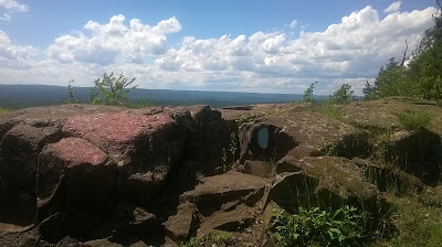
Too nice a day to not run, even though I had a scheduled evening meeting. Out to the Metacomet on Route 20, and jogged 3-miles total in a brilliant sky day. Great day to be on the trail.
Tuesday, June 27, 2017
Monday, June 26, 2017
Magnificent day, mid sixties and sunny. No humidity, No bugs, and No snakes! I felt decent, or at least better than I have been regarding leg discomfort. I planned on driving to Savoy, for three possible destinations....
First, to get back on the Berkshire Natural Resources Council Hoosac Range Trail to Spruce Hill. I've written (March 22, 2017) of a Spruce Hill vision. This would be my first visit back since early in 2015 (very hard to believe, as I used to routinely make it to Spruce Hill monthly).
Second, I'd cross Route 2 above the Wigwam and Western Summit Gift Shop to head to "Top of the World", and then further north to Canyon Brook. Once at Canyon Brook, I would hope to venture downstream to potential waterfalls I had read about in "Wild Side Adventures" by Nan Williams.
Lastly, I have been doing some research on the Second Hathaway Cemetery, in Savoy. Middle of nowhere, no trail leading into it, sounded fun.
Things worked out pretty well. I covered 7.1-miles between the Hoosac Range and Top of the World.
The Hoosac Range Trail to Spruce Hill was in fantastic shape, the first couple miles recently weed-whacked even. This trail is easily in my top ten trails to explore, it's got climbing, views, and scenery. There is an old path leading east toward a large pond that I need to explore on my next visit.
Once back at the BNRC Kiosk, I continued across Route 2 and up the service road to the cell tower. The short run out to Top of the World, which I had last visited toward the end of May, 2015, was awesome. The image on the top right of this blog homepage is from that visit, with Tippi walking toward the edge. After the view, however, the trail developed into multiple, large mud-holes. It's obvious that it has been a rainy couple months. I decided to bail on the potential waterfalls (I imagine with this much water it would have been great) and head to Savoy Hollow on the Windsor border for a graveyard search. I'll be back for Canyon Brook and Falls soon enough, when things dry out just a bit.
To get to Savoy Hollow, I decided to check Black Brook Road. It looked "open" when I drove past this morning (the road was totaled and closed since Hurricane Irene). It is now open, and in great shape!
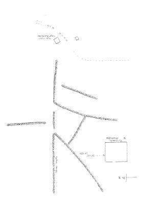
To find the Second Hathaway Cemetery, I plotted a "clear" area in ArcMap after downloading LiDar data for the area. The spot I picked looked right, and I thought I could see a stonewall around the clearing. To get there, I decided to make it fun, and memorize stonewalls that would lead basically to the graveyard. These stonewalls show up fantastically well in the data.
I found the Second Hathaway Lot, and it was really memorable. The only mix-up I had was one of the stonewalls I needed to follow stopped before it was supposed to (should have intersected with a east/west stonewall). This lead to me wandering a bit, and following a stonewall I "thought" was correct but I couldn't be sure. All worked out in the end, and I left the area a pretty happy visitor.
The search for the graves took about 2-miles of hiking. I exited along a snowmobile trail for some of it, and by the looks of the notes and the LiDar image, I walked right by a cellar hole I would have liked to have viewed. Looks like another visit will be necessary!
Berkshire Natural Resource Council's Hoosac Range Kiosk
View from Sunset Rock on the Hoosac Range Trail
Hollowed trunk along the trail
Two large quartzite
boulders on the trail
The Hoosac Tunnel passes underneath this location
View southeast, with Borden Mountain at the far left
Looking off Spruce Hill toward Greylock
Proof positive I am where I thought I was!
View north with both sets of windmills viewable
A side trail with a view of Greylock
Top of the World, looking at Greylock
Rough Location of the Second Hathaway Graveyard (green dot)
LiDar showing the stonewalls as raised surfaces (green dot still visible)
My route following the stonewalls and finally getting a little lucky!
The gate and stonewall surrounding the Second Hathaway Cemetery
Many graves are still standing
Welcome Stanton and L. Clarinda Stanton
Looking northeast toward the surrounding stonewall
Sunday, June 25, 2017
The day was very sunny, yet not too warm and wonderfully breezy. I felt like I wanted to do something long and slow, to see how I would hold up. By this I mean not too long, and very slow.
It was shady along Phelps Road, so I parked in my normal spot to run the Metacomet. My last run on the 8-mile out and back was a really good one, but I had no illusions of this being a record setter.
The good news was I made it through the 8-miles, and didn't feel that bad until the last mile or so. It is really going to be great to get better from this Lyme Disease. All in all, I call not only today a success, but the last three days of running as well.
Copper / Peak Mtn with a view of Talcott in background
Another view slightly north of Peak Mountain
Saturday, June 24, 2017
The visit to Penwood yesterday revived me a bit emotionally and spiritually. I'm still not rid of the fatigue and discomfort from the Lyme infection, but my legs felt better this morning while working on the patio so I thought I'd head back to the same basic area to run the opposite side of Route 185, and add some climbing in.
The parking lot at Penwood was about half-full at 10:00 a.m., and it was still very humid and warm. As I made my way along the climb to Hueblin Tower, wind was trying to pick up and the humidity dropped significantly. This felt refreshing, and each time I was feeling "too warm" a nice breeze would appear. The route, which is a nice loop on a stem, tracked out at 5.7-miles. This will be either the last or first section of a planned marathon, stretching from Southwick/Agawam to Talcott.
START SECTION END SECTION DISTANCE TOTAL
| Route 57 | Rising Corner | 2.3 | 2.3 |
| Rising Corner | Mountain Road | 2.6 | 4.9 |
| Mountain Road | Route 20 | 5 | 9.9 |
| Route 20 | Hatchet Hill | 2 | 11.9 |
| Hatchet Hill | Farmington River | 2.2 | 14.1 |
| T-Ville Section | T-Ville Section | 0.5 | 14.6 |
| T-Ville | Penwood | 2.2 | 16.8 |
| Penwood North | Penwood South | 3.1 | 19.9 |
| Talcott-Hueblin Loop | 5.7 | 25.6 |
The High Elevation of the run, Hueblin Tower on Talcott Mountain
Prior to Hueblin Tower, there is this nice opening/view in the trail
Massive walls of rock east of Little Phillip Mountain
Second snake sighting in two days, this one a bit smaller
Friday, June 23, 2017
Wandered out to Penwood to see how I would hold up over the 6 1/2-mile loop around the park. The warmth and humidity have returned, and the deer flies are just beginning to appear. Despite these negatives, I had a decent run. I was able to drop my prior best time from April of this year (1:34:00) to a respectable 1:28:00 today.
I am still having some lingering aches in my legs, I am a little over half-way into my lyme medications. Not uncomfortable enough to not try running, but it will be something when all symptoms leave me.
View from the top of the Pinnacle
First large snake of the year that I almost stepped on (~4-footer)
View from the lookout south of Pinnacle
On
this day in 2012, Wuzzam and I completed a Metacomet Marathon, with a time of 7:00:00. Tippi ran the first section with us, from Route 20 to Phelps Road, and back (about 10.5-miles). Weather report was that heating up was very possible - so the Donnalee grabbed Tippi early. This was my 46th marathon completed.
Our Route for the Marathon Distance.
Thursday, June 22, 2017
Wednesday, June 21, 2017
Today was break from running, so I did some mapping. Have it in my head that it would be interesting to know the high elevations for all towns in Berkshire, Franklin, Hampshire, and Hampden Counties of Massachusetts. The map isn't fancy, but it is starting to show results as I completed 15-Towns in Northern Berkshire County.
Going back in time...
On this day in 1998, my Pop and I completed the 1st Greylock Centennial Marathon in Adams, Massachusetts. Our time was 6:55:38. This was a very difficult course, with 5 lengthy climbs.
Going back in time...
On this day in 1998, my Pop and I completed the 1st Greylock Centennial Marathon in Adams, Massachusetts. Our time was 6:55:38. This was a very difficult course, with 5 lengthy climbs.
Tuesday, June 20, 2017
It felt like the humidity broke, but it still made the high '80's today. Nice breeze though, which made it very comfortable in the woods. I still am keeping the running short due to the lyme disease flare up / doxycycline prescription; I am on day 11 of 21 with the medications.
Tackled the Metacomet from Route 20 in Granby north to the scout camp-site and back. 4-miles of beautiful blue sky, soft blowing breeze and bright sun in a clouded sky.
View from Copper / Peak Mtn, 1-mile out
Approaching the view at 1.5-miles out
Looking south from 1.5-miles on the exposed rock
Monday, June 19, 2017
We're still in a pattern of high humidity, and possible heavy rain, so I headed out early to McLean Refuge. Back on June 2nd I explored the western Barndoor Hill, so to not leave the east-side out I made it my focus today.
Pretty much all the trails in McLean are well managed and enjoyable, and there are a lot of them. There is a fairly complete map available at the Mclean website. The trail up to the eastern Barndoor Hill is a decent climb, with several rewarding views, and horseshoes back to the main route over the hill. Finished my morning run with 3.7-miles, and a smile on my face (beat the heavy rain!).
View west toward the Western Barndoor Hill
Another view west toward the Western Barndoor Hill
Mclean Refuge Map
Subscribe to:
Comments (Atom)


