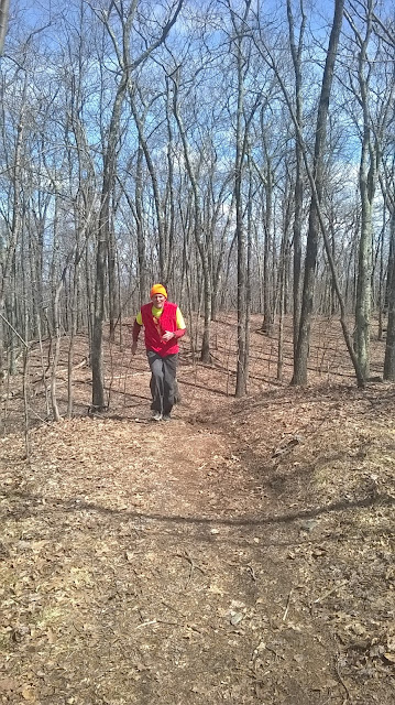
Saturday, April 14, 2018

Possibly the nicest day of the year so far.  I thought McLean would be fun, and I rambled through 7.9-miles at a comfortable pace.  There were an abundance of people enjoying the woods, many with their dogs, which makes me happy.

Start / Finish at Canton Road parking area


Friday, April 13, 2018

Back to the Skyline Loop including some of Hamden's Hills today, with temperatures climbing into the '70's.  Wuzzam was ready, and I fitted him with Tippi's old radio/gps collar so that I could "see" his progress on my Garmin Astro 320 (actually, this was in case he wandered at a turn, I'd be able to see it).

I guess that I was so worried about Wuzzam that I missed a turn at around 6/10 of a mile and put an additional 3/10 on the run.  Other than that, we did really well, and Wuzzam found his way.  I cut briars around mile 6, which will be a big benefit as the year moves on, and we hopefully continue working on this course.

The climb up Pine is really a brute;  I took the more "right" path this time, and it looks to be a little longer and no easier.  At the end of the day, I had run 1:49 for 8-miles, which was a huge improvement from last week's 2:10 for 7.7-miles.  I'll take it.

From the little spur on 880, looking east


Thursday, April 12, 2018

Metacomet Trail from Route 20 to the Boy Scout Camping area, 2-miles out from the trail-head.  I did not get rained on, and I managed four good miles on my legs.  All in all, a great afternoon.

Looking south toward the Heublein Tower

Wednesday, April 11, 2018

SOLITUDE, HEMLOCK AND A FRIEND

(Originally written April 26th, 2000)

Mountain Road splits the rocky Metacomet Trail in two at the top of West Suffield, with the majority of people following the path south towards the cliffs and views of Old Newgate Prison.  I usually choose the closed down section heading north to the Massachusetts border; the once continuous trail now regulated to dead-ending in the back of someone's yard.

There are plenty of options for trails close to my home, so why do I keep following this same path day after day, week after week, year after year?  This is a question I am sure many of us ask ourselves as we plod along a familiar trail over and over.  I don’t think the answer is a simple one, or even one single answer.  At least it isn't a single answer for me.

I guess that few others travel this route make it appealing to me.  The "other side" has a lot of traffic; hikers and mountain bikers have discovered its attraction.  I like the solitude of the woods, the quiet.  It is nice to be alone, and this short section of trail allows that.

I also choose this path because it holds a section of hemlock, a dark cavernous stand of trees that have so far avoided being cut like many of the others in Connecticut.  The way they deflect the sunlight from reaching the forest floor intrigues me.  The soft needles at their base lining the trail cushions each step.  Their size places me back decades for the brief moment I race through their natural hallway in the forest.  By the time I arrive each day at this section about a mile and a quarter into the trail, I have usually emptied my mind and daydreaming starts, my favorite moment of any run.  It is what I try to capture on each outing.

Another more intimate reason for enjoying this path is it helps me remember a friend.  It was here, along this section of path, from 1993 to 1998 I would run into Nick walking his labs, anywhere from a few dogs to a dozen.  3 or 4 times a week, 52 weeks a year, close to 5 years worth.  There were plenty of days when we just said a quick "hello", and passed each other.  There also were days when I would stop running and finish the miles hiking and talking with him.  Over time we became friends, two guys taking their dogs out into the woods each day.  I like to think that we shared some of the same reasons for sticking to that route.

Nick passed away unexpectedly in late summer of 1998, but every once in a while I bump into one of his sons walking the dogs along the trail.  It makes me smile to see one of his family members looping around the mountain over the same 3.5 miles he did thousands of times.  A real hit of sunshine, regardless of the weather.  Mostly though I don’t see anyone, but I know that Nick is still walking that ridgeline every day.  It is something I can feel.  He is still alive in the dirt, the trees, and the quiet sounds of the forest.  He left an imprint in that section of forest, at least on one person.  I continue to travel alone along the same path I had for a couple years shared with a friend, paying my respect.

Seasons change, I change, even the woods here change due to logging.  The routine for me hasn’t changed yet, though.  I have my reasons for looping along the abandoned Metacomet Trail on Mountain Road, West Suffield.  My choice comes down to solitude, to hemlock, and to a friend gone.  One is welcomed, one is trying to survive, and one is missed.
{04/26/00}

Tuesday, April 10, 2018

Music 2018...

Effort #15, Cotton Crown.  Going back to Fort Worth, Texas in 1988 with the Reverend as The Road Warriors for Christ.  A quiet Sonic Youth interpretation.


Monday, April 9, 2018

Out to the Metacomet after work, Phelps north for 3.6-miles.


Sunday, April 8, 2018

Today would tell us whether the fieldwork I'd been putting in would be a success or not;  an actual start to finish attempt would be made on the old Skyline 8-Miler from the late '90's early 2000's of K.S.  (aka the Wednesday Night Run).

Wuzzam was game, and the short story is we successfully completed the loop without going off track.  The only difficult part was immediately from South Road to climb 880...  a short section was difficult to see after the brook crossing, and then just before the real climb starts deer and/or turkey had disturbed the ground cover so severely that we could not see any sign of the old trail.  We reconnected within twenty or thirty feet both instances.

Wuzzam has been concerned about his climbing, especially as he has Wapack End-To-End on the near horizon.  We counted 5-climbs in this loop:

1) Initial climb from the start to top of Skyline Lookout
2) Minnechoag Mountain
3) 880
4) Pine Mountain
5) Backside of Skyline from South Road

We've got some briers to cut out just prior to South Road, but other than that the course is in good shape.  It is much more open than what we remembered from 18 - 20 or so years ago, logging and development have taken a bit of a toll.  It will be interesting to see what it looks like once the leaves come out.

At a "new" clearing, with a mass of white birch in background

Wuzzam at the marker tree

Top of Hill 880'

Climbing to the top of Pine Mountain


Saturday, April 7, 2018

The sun came out by noon, but temperatures remained only around 40-degrees.  I thought about a longer run, but settled on the Metacomet section between the north end of Penwood (Wintonbury Road), and Tariffville.

Totaled 4.6-miles, with some side paths on the return.

View south

Bartlett Tower

Old Chimney Remains (no longer on the blue blazed Metacomet)

Friday, April 6, 2018

FANFARE FOR THE WARRIORS

(Originally written April 1st, 1999...  so some of this no longer is accurate)

I have participated in each 7 Sisters Race since 1992. I’ve had some excellent finishing times and also some not so excellent times. That doesn’t really matter much. Honestly, it has been the struggles that I recall with the most clarity and detail. Those were the years when the finish line looked best. As "Big Man" Stan recently said about a completed excursion on this course, "…because it was beautiful doesn’t necessarily make it pretty".

I believe that once you experience a little success at 7 Sisters then the difficult times need not be looked upon as "bad ones" but merely steps to regain that magical moment from once or twice before. What I have been taught is that we don’t have to be at our best to enjoy this race year after year. Participating should be plenty, and for knowing this I am thankful.

Other pieces of information I have learned from this event are…

This is the only day of the entire year that Race Director Fred P smiles. That should be a clue to what you are getting into. 

Haven’t run 7 Sisters before? Best of all is knocking this one out for the first time. I believe many trail racing memories I retain tend to be from the first attempt I had at a course. That is the feeling I wish to re-experience each time I show up. Cross the finish complete with that wild-eyed look pouring out of me like Bogart first viewing Bacall in Key Largo. It’s all in the eyes. Each of us may feel it elsewhere, but the truest indication of success will not be told on the scorecard but in the eyes of each finisher. The windows of the soul allow everyone a glance to into your contentment that day. 

Worried about being slow or finishing at all? Take strength in that the more time spent trying to complete the Sisters will be that much more time you will be able to go way inside yourself and explore those emotions that normally scare the shit out of you. 

The possible range of finish times will be almost 4 hours for this 12-mile race. The winner will most likely be < 2:00 and the final participant finishing somewhere between 5 and 6 hours. This is for a twelve-mile race. 

Since 1992 only 23 men and 4 women have dipped under the 2:00/2:30 six pack challenge. If you start to dig into this stuff though, you’ll realize that only 13 different men make up those 23 occasions. Each of the ladies has been different however. These are not good odds. 

Listening to many first time entrants relate their experiences, I believe that those who venture in from a background of hiking tend to enjoy this course more and keep coming back. The "SlugRunner" is a prime example. Those of us who are used to walking and are not obsessed with time seem to be able to accept this style of "running" easier than those who only want to blast through  

If you finish this race, no other course in the Grand Tree circuit will be "intimidating". Some may be too much distance, but for shear difficulty this is as hard as New England gets. You will be loaded with confidence after completing this one. 

I used to try hard at this race and attempt to run as much of the first hill as possible. It would take me about 8 minutes to reach the top of Bare Mountain. A couple years ago I started to walk this section entirely. This took me 12 minutes. When the race starts and you find yourself behind a hundred people who seem to be going too slow, don’t worry so much. If you are trying to win the event you should have been at the very front to start. If winning isn’t the goal, everyone will spread out soon enough and the 4 or 5 extra minutes walking at the start isn’t going to hurt your overall time, chances are it will help it. 

Completely running out of gas and regulating oneself to the side of the trail to sit is more apt to happen for those of us who start too fast. I have never viewed anyone behind me stop to rest, only those who have been in front of me. Take out of this whatever you wish….. 

One of two things is almost certain after this race. Either you’ll be so hungry you’ll sample every bit of food the Notch Visitor Center has to offer (part of your entry fee), or you’ll not be able to eat at all. I haven’t really noticed any "in between" stage. 

Depending on individual goals and aspirations success is decided differently. Regardless of competitive level or lack of, the ticking time clock shouldn’t be the only indication of achievement. It is each of us out there in charge of our own thing. Get out of this what you want to.

{04/01/99}

Thursday, April 5, 2018

Windy, cold day despite the afternoon sun.  Stopped at East Granby Farms and ran up the connector to the Metacomet, just below Copper/Peak Mountain (roughly a 600' elevation gain).  Continued on to make a 3.4-mile run out of it.

View south from Copper/Peak Mountain, with Talcott Mountain in background

Looking west off an unnamed lookout along the Metacomet

Wednesday, April 4, 2018

Rain on and off all day, but from 5:30 to 6:30 p.m. the sun came out...  so I went to the Metacomet and ran from Phelps Road north, 3-miles.

View west from Metacomet Trail

Tuesday, April 3, 2018

Music 2018...

Effort #14, Bill is Dead.  A mellow song by The Fall.  I am really captivated by the "greatest times of my life refrain...".

Monday, April 2, 2018

Continuing to track my "peaks", or at least "high points" along the trails I cover.

March's High Points:
  • Hart's Pond Hill, Agawam, MA
  • Hatchet Hill, Granby, CT
  • "Nick's Hill", West Suffield Mountain / Metacomet Ridge
  • West Suffield Mountain, Metacomet Trail, Suffield, CT
  • Perkins Mountain, Somers, CT
  • Skyline Overlook, Somers, CT
  • Rattlesnake Hill, Somers, CT
  • Minnechoag Mountain, Hampden, CT
  • Stony Hill, McLean Refuge, Granby, CT
February's High Points:
  • Skyline Overlook, Somers, CT
  • Goat Rock and Lookout Point, Hampden, MA
  • Minnechoag Mountain, Hampden, CT
  • "Nick's Hill", West Suffield Mountain / Metacomet Ridge, Suffield, CT
  • Hill 880', Hampden, MA
  • Pine Mountain, Hampden, MA
  • Perkins Mountain, Somers, CT
  • West Ridge, DAR State Forest, Goshen, MA
  • Walnut Hill, Williamsburg, MA
  • Copper - Peak Mountain, Metacomet Trail, Granby, CT
  • West Suffield Mountain, Metacomet Trail, Suffield, CT
  • Merritts Hill, Williamsburg, MA
January's High Points:
  • "Nick's Hill", West Suffield Mountain / Metacomet Ridge
  • Bald Mountain, Shenipsit State Forest
  • The Pinnacle, Shenipsit State Forest
  • "Balanced Rock Hill",  Shenipsit State Forest
  • "Bent Birch Hill", Shenipsit State Forest

Sunday, April 1, 2018

Mid-morning run along the Metacomet from Rising Corner, Suffield, to the Agawam Bowman's Club on Route 57.   4.2-mile round trip, with a little more get-up-and-go in my steps than yesterday.

Stone marker just prior to new bridge-work

North of bridge, flowing to Harts Pond

Southern view from Bridge

Saturday, March 31, 2018

An awesome sunny day in the upper 50's.  Drove out to the Metacomet Crossing at Route 20 in Granby, and headed south to the Farmington River at Tariffville.

The section from Hatchet Hill Road to the Farmington River, which includes a slew of side-trails to Cowles Park (and elsewhere), was well populated with bikers.

Enjoyable day, I ended up with 8-miles of very slow going, especially the last 2-miles.

View south from above Tariffville Gorge

View north from above Tariffville Gorge

At the Farmington River

Old Burial Ground, being "updated"