Saturday, March 26, 2016

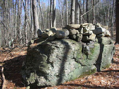
Giving the Shenipsit Section between Route 190 and Gulf Road a try today.  5.1-miles, beautiful day.  There are some interesting stone piles slightly off the trail, several of them in a close proximity.  It is possible to look at my map and see where I "stumbled" around a bit looking at and photographing these mounds.

Close Up of Stone Mound. 

Longer Shot of Mounds.
 

Friday, March 25, 2016

A trip to visit my parents in Adams made it logical to stop in Ashfield on Route 116 / 112 to enjoy Ashfield Trail network.  Slight rain, but not too bad.  3.9-miles of fun.

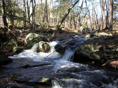
Along the way I took a few pictures of Sherman Springs in Savoy.

Locally famous Sherman Springs! 

I've made a point of noticing markers along my travels.  I respect and feel the loss. I pass by this roadside memorial often when traveling to visit my parents.  It is on Route 9, in Cummington or Goshen.  Here is a photo from today, followed  by one I had taken years ago when it had been freshly painted.

March of 2016.

August of 2005.

Sunday, March 20, 2016

4-miles on the Metacomet Trail in Suffield, Connecticut.

One of the many lookouts along the trail.

Tippi taking a look from Peaked, aka Copper, Mountain.

Weekly Total, 19.5 Miles.
Yearly Total, 129.3 Miles.

Saturday, March 19, 2016

Shifted up and went to Barkhamstead area, the Tunxis Trail near Ski Sundown.  We did well with a 7.8-mile run down to Satan's Kingdom and then back plus.  Haven't updated the Tunxis geodatabase yet, so map is not ready.

My dog Tips on the Tunxis.

Friday, March 18, 2016

It is hard to believe I haven't run in Shenipsit / Soapstone area in over a decade.  With so many new trails it is like I've never been here before.  Constant field-work with GPS data will really cement the new network in my mind.  A short 3.3-miles for this one.

Wednesday, March 16, 2016

Thinking about reviving our mid-week trail runs from a few decades ago...  the Bald Mountain Pond / Marsh area has many new trails to explore, so we explored a 4.2-mile run.  As is the case with Soapstone Mountain area near the Tower, there are many, many intersecting trails here that are unmarked and unblazed.  Be aware of your direction if exploring, especially later in the day.

 Wuzzam and Tedziu, post run.

Route taken, northern most section was our turnaround point due to fading daylight.


Sunday, March 13, 2016

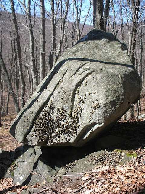
Took a drive to Adams to visit the folks.  On Route 116, in Plainfield, I have noticed a huge boulder slightly off the road.  Today, I decided to stop and look... it deserved a photograph.  The stones towered over me.


Saturday, March 12, 2016

Another trip from Galbreath Road in Shenipsit State Forest.  7.6-Miles of fun.

Nice Signage from CT DEEP...   I appreciate the attention to the area.

Total for Week, 11.8.
Yearly Total, 109.8.

Friday, March 11, 2016

The plan was to enter Bald Mountain from the south or east, and the route has been tied up successfully. 4.2_miles.


Tuesday, March 8, 2016

Buried a friend and neighbor today; Sandy had a long battle with cancer, and fought hard until the end.  She was a wonderful neighbor and will be missed by the entire community.

After the service, I wanted to spend some time thinking so I visited Bald Mountain Area, hoping to get to the top as well as the Pinnacle if I was to be fortunate.

Parked at the Bald Mountain Preserve off Scully Road.

Ended up finding what I was looking for, in slightly over 7-Miles.

 Small Pond at beginning of Route to Bald Mountain, approach from the west.

 Large Boulder near above pond, approach from the west.

 Balanced Rock below the Pinnacle.

Stone Wall North of the Pinnacle.

     Mound and Balanced Stone, north of Pinnacle.
 

Close up Balanced Stone, north of Pinnacle.


Sunday, March 6, 2016

Getting out on Shenipsit Trail, off Galbreath Road.  I was hoping to run over Bald Mountain and the Pinnacle, recreating part of an old run a bunch of us used to do every July (Thanks Kevin S).  It has been a very long time since then, and I hadn't visited Bald Mountain or the Pinnacle in well over a decade.

As I hit what was sort of the first peak of the day, on the Blue Blazed Shenipsit Trail, I realized that I wasn't on Bald Mountain, and I wasn't west enough.  Evidently, the old Shenipsit Trail has been re-rerouted!  I have to admit, the work done on this new section is phenomenal.  Bald Mountain and the Pinnacle would have to wait for another day.  Ended up with 8-miles on my legs.

The Whistling Tree. 

 Huge Grouping of Stones uphill from the trail.

Balanced Rock slightly off trail, looking easterly.

  Same Balanced Rock, looking westerly toward Bald & Pinnacle Ridge.

 An Old Well, I've located a few of these in this section of forest.  No Cellar Hole nearby.

Route from the Day.

Total for Week, 11.0.
Yearly Total,  98.0

Friday, March 4, 2016

The Metacomet Trail in Suffield, Connecticut.  An easy 3-mile out and back on this route, a trip I have done hundreds of time over the past 23 years.

Sign at the Chimney.   

Tippi checking back on me.  Trail Companion for close to 20,000 miles.

Sunday, February 28, 2016

Soaptone, from the South (Hopkins Road).  Did some retracing and back and forth, to connect trails.  We covered roughly 6.2-miles, with many interesting rock settings to witness. 

One thing with Soapstone Area Trails is that there are many, many trails, very close together, often doing the same thing.  I love trails, and connecting them...  but in here there are connectors connecting connectors.  

On the other hand, if you don't like the current trails in Soapstone, just come back to visit in a couple months, and there will be more to choose from.  They pop up that often, built by multiple user groups.

Standing Stone, 5-6 feet tall, along Race Course Trail.

 Shelter Stone, ~8 feet tall.

 Sam & Bobzu within Shelter, for Scale.

 Perched Set Slab.

 Our Route on February 28th, 2016.


Mileage for Week, 16.9.
Yearly Total, 87.0.

Saturday, February 27, 2016

Another Visit to the Metacomet Trail in Suffield, Connecticut.  Nice to take an easy 3.1-mile out and back on this route.

Remnants of Old Chimney slightly off main trail.

Friday, February 26, 2016

Nipmuck Trail, from Boston Hollow, along the Marathon Route with Sam & Bob.  7.5-mile out and back.
Stacked Stone near Eastford Road.

Another Angle of Stacked Stone.

More Modern Structure near Natchaug SF.

Pixie Falls, located between "C" and "H" in Natchaug on map.

  Hollowed Tree Roots at Pixie Falls.

 Our February 26th, 2016 route.