Sunday, May 15, 2016

A good trip out to Bigelow Hollow, former home of the "Breakneck Trail Race", which I participated in all 13 years it was held.  Fond Memories for that great event.

The Old Goat was joining me, after all, he did invent "Breakneck".

We took trails I don't get out on much, and it was really special.  I should make this drive more often - there is a lot of exploring for me to do here.

10.5 miles total, good conversation catching up.
 
Prior to completing our Mashapaug Loop...

Another angle...

Entry Sign.

Mapped Route.

Saturday, May 14, 2016

It seemed like a long while since I visited East Granby Farms.  Got out late in the day for about 4 1/2 miles, with some exploring mixed in.  One of the trails I used to run often, to connect in a roundabout way to Sunrise Park in Suffield, seems to have houses instead of woods.

The area and trails are heavily used by motorbikes;  it's always been that way, and the motorbikes most likely are responsible for the majority of trails into the eastern side of the ridge.  Seriously, they always had been pretty well maintained and not overused by any means.

Top of the Grassy Hill, Bench and Signage.

Another view.

Old Chimney along base of Ridge.

Abundance of Stone Walls throughout the shelf between the fields and the Ridge.
 

 More Stone Walls.
 

 Close up.
           
Interesting "Mound" with a stonewall.
     
Close up of "Mound" stonewall.

 Large interesting rock formation.

Same rock in relation to the stonewall leading to it.

A balanced rock along the stonewall.

Route for the day.

Friday, May 13, 2016

Just enough time and energy to get in about 5k in Shenipsit State Forest.  Began off Route 140, after a mix up trying to get there through Ellington.

Enjoyed the run, and this portion of the forest is beginning to make sense to me.  Map below....


Monday, May 9, 2016

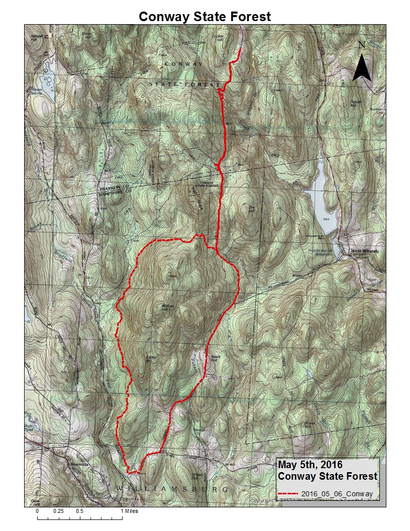
Made a day of it during some great weather.  Ashfield Trails, starting at Bear Swamp in Ashfield, Massachusetts.  I would be running on trails built and maintained by Ashfield Trails (awesome work).

Finished with a total of 14.9 miles in roughly 3:43:00.  Ran along an old route that I had snowshoed on many years ago (to Mary Lyon Hill), and it was fantastic seeing this utilized as an all season trail.

Tried to re-connect along the old snowmobile trail through the Khandroling - The Land of the Dakinis, but I was not sure of the land being open to visitors, so I aborted.  

Did visit the Mary Lyon birthplace, which was awesome.   And I spent worthy time with a landowner along the trail, "Dick".  Wonderful story-telling man.

Brewer Tatro Memorial Woods signage opposite Bear Swamp.
  
Northwest Cemetery, along Ashfield Trails.

 Beautiful old tree along brook.
  
Closer of old tree along brook.

Looking up at the crown.
  
Smith Brook, just prior to the Smith Road crossing.

 Signage for the Stone Bridge, between Smith and Strohecker Roads.

 The Stone Bridge from below.

 A bit longer shot.

Sentinel tree on top of Ridge Hill, with stone walls along perimeter.
   
Close up on ridge.
   
 Mary Lyon Birthplace marker stone.

Well at Mary Lyon birthplace.
 

Mary Lyon birthplace foundation.

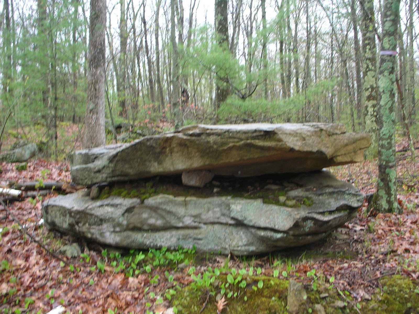
 An old birch sharing location with a rock.
 

Almost finished, the view above Bear Swamp.


Sunday, May 8, 2016

Wonderful visit to see my Mom for Mother's Day today.  On the way home, I explored the area around east of Plainfield Pond a bit.  It is a really neat area with three additional large water bodies in the vicinity.


Large Boulder Area East of Plainfield Pond.
  
More Large Boulders.

Saturday, May 7, 2016

After a quick drop at Bradley, K2 and I went out to Shenipsit with an attempt to beat the rain.  Decent Run after yesterday's lengthier effort...  3.5-miles and we just managed to get to the car prior to the rain striking down.

Interesting rock pile.

 More interesting rock formation.

Large Balanced and Supported Rock.

Perched rocks.


Friday, May 6, 2016

It was such a beautiful sunny day today, I wanted to explore.  I hadn't been to Conway State Forest in a couple years, so it was my destination.  I planned on the Henhawk Trail, with a search for the balanced rock up on a hill I had been to once, years ago.

The run north went really well, it was a great trail and interesting.  The northern section up toward Cricket Hill was new to me, and I was especially impressed with Avery Brook.

On the way back, I took a little used single track, which headed west up the ridge (and I thought might get me to the balanced rock).  This was a really nice single track, but looks to be a little under construction after reaching the height of land.  It ended up turning into old logging road / snowmobile trail (and in defense, some of it was really nice), and it was a good thing I felt like exploring because it took me completely around Walnut and Carey Hills, almost two-miles further south than where I parked, and a bit west as well.  I never came close to the balanced rock, so that will have to be for another future day.

I ended up on Nash Hill Road, almost at Route 9 in Williamsburg, and took the road back to the car.  It wasn't a great ending to the run (I would have preferred to stick in the woods) but my final tally was 13.5-miles, enough for a the day.

Avery Brook, just beautiful.
 

Thursday, May 5, 2016

A trip to Savoy, Massachusetts, back to my youth.  My goal was to get some running in along Brown Road, and locate an old cemetery that has been eluding me for close to two-decades.

I recall back in the '70's seeing the Staples Burial Ground on "Cherry Hill Road".  Over the past decade I've made some trips to view it again, but I kept getting shut out.  Today, I felt it would be different.

The run along Brown Road reminded me of all the Savoy Trail Races I had trained for and finished.  I remember snowmobiling Brown Road as a teenager in the '70's, coming up from High Bridge and heading toward Matt's Lodge to play pinball.  My mind wandered, came back to me, and there I was...  right where I needed to be.

Outside steps leading into Staples Burial Ground.

Samuel  Staples Gravestone.

Inside steps leading out of Staples Burial Ground. 

"Patty" 

I explored more of Brown Road, running south to the intersection where I could have taken a right to Route 116 and the Tomb Cemetery.  Along the way, the stonewalls were amazing - not only along much of the old road, but shooting off into the woods often enough as well.  I found a future project, mapping those stone walls along Brown Road.

Odd stone work...  along the way.

Really rewarding run;  I found what I was looking for and also some things I wasn't.  Ended with 5.2-miles and feeling good about things.

Wednesday, May 4, 2016

A day that threatened rain, so I remained close to home and explored more Shenipsit.  Had a nice 7.4-mile run off Parker Road.  Made it to the giant boulder the Old Goat showed me a summer ago. 

This rock is large, taller than a grown man.

Interesting mound along the way.