X-Rays on left foot and toe. No fracture present. Rest prescribed.
Thursday, July 15, 2021
Tuesday, July 13, 2021
Back out to Granville, trying to find my way from Beach Hill Road to North Lane through the woods.
Gave it a go, wandered, bushwhacked some, and found an old wide path that has promise.
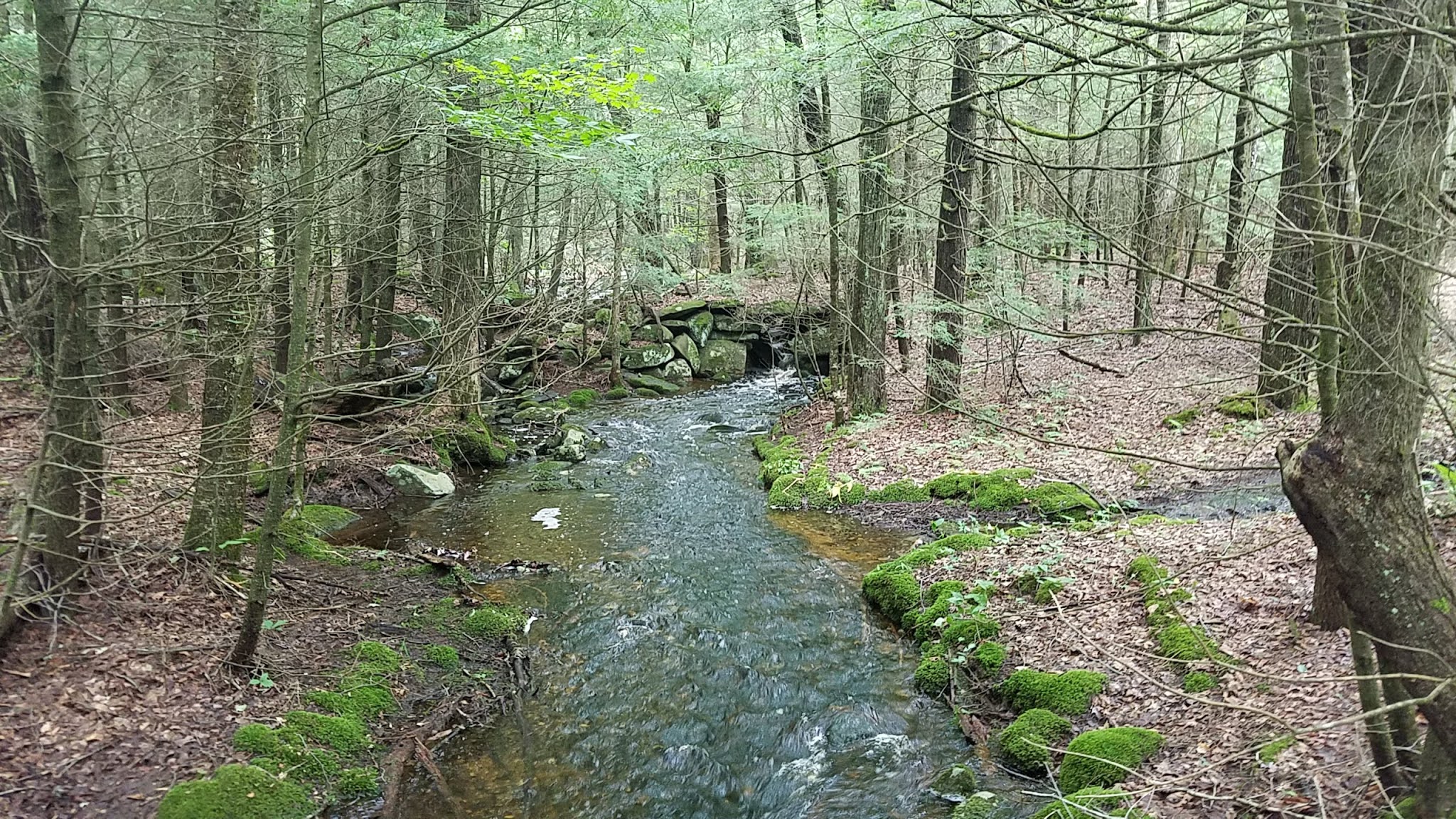
Smashed my sore left big toe badly around the 2-mile point, and broke the darn thing but good.
Shuffled and walked another mile, then turned back in the drizzle.
3.9-miles, with some promise that I am on a good route. The toe aches badly.
On an additional side note of good-fortune, I passed my eye exam today -- another year with fine vision.
Impressive Swamp

Rocks Incorporated as Trail


Monday, July 12, 2021
It poured rain all early morning, but there was a break around noon so I explored Granville a bit.
I drove to Phelon Forest off North Lane, hoping to connect to my previous journey through this parcel back on June 20th.
The wide-trails were deep pools of water, and most of the smaller single-track trails were streambeds. It wasn't a great day to be in the woods, but for the time I was present it did not rain on me (that waited until I was back in the car).
The exploring covered 6.6-miles, soaking my shoes for the second straight day in these New England woods soaked with excess water from the past two weeks of steady rainfall.
There were good connections to the gas-line, and back out to North Lane on two-seperate paths. A true single-track was the highlight of the run, leading from the gasline back to connect behind the tower (not viewable from the trail today (heavy fog/low visibility)).
Phelon Memorial Forest Sign

Balanced Rock at View

Another View Balanced Rock

Another View Balanced Rock

View northeast from Lookout

Perched Rock along stream on single-track


Sunday, July 11, 2021
I wanted to connect last weekend's run from Tolland into Granville off "Sheets" Road and toward Beech Mill Road at it's intersection with "Lover's Lane".
It would be great to include a few new sections on Blandford Road as well, if possible.
Made great time running out the 4.5-miles (or so) from Schoolhouse Road to Beech Hill Road, averaging about 5.3 mph in serious water due to all the heavy rainfall of the past two-weeks. Explored and luckily things are coming together well throughout the adventures.
Stumbled upon a nice cellar hole on the snowmobile trail / Blandford Road that connects to Farnum Road section. Also noticed a couple of "balanced rocks" along this route, but I honestly couldn't tell if they were recently "placed" in their position by heavy equipment (which normally isn't a concern, but these are just off a road that seems like it does get some maintenance although in very rough condition.
Finished with 9.3-miles, with somewhat bothersome deer flies, but on a good note I beat the rain by only minutes.
Swamp north of Blandford Road

Brook with stonework
Foundation Cellar Hole

Well at Cellar Hole

1st Balanced Rock

2nd Balanced Rock

2nd Balanced Rock


Friday, July 9, 2021
I missed the Suffield Summer 5km Series at Bruce Park Monday night, but figured to run a "solo" / unofficial attempt after work tonight.
The rain from the Hurricane remnants finally let up, but the sun came out something fierce by 5:30 p.m. when I started.
I moved through the first loop well, feeling like I was "pushing it" but not red-lining. I think my timer read something like 12:30 at the end of loop-one, which had me wondering.
Second loop felt a bit worse than the first, and at times I felt like I was crawling, but when I finished my timer had me completing the 5k in 25:20. Fastest time yet, and 1:40 better than last Monday's race in the heat-wave.
Solo run on this course isn't terrible. The fact that I have some race-times to base off, and running it goes by fairly quickly are bonuses. I may be back.
Wednesday, July 7, 2021
Tuesday, July 6, 2021
Monday, July 5, 2021
Sunday, July 4, 2021
Right back to yesterday's starting point, Schoolhouse Road in Tolland. This time, I would explore the snowmobile trail going west.
Route was on the Tolland State Forest Map from Massachusetts DCR. There was a spur off Belden Road that leads to the gasline right-of-way. Due to the grown in nature of the grass, and my fear of ticks, I didn't pursue this during summer-time.
On the way back to the trail, I rambled down Belden Road a bit past the Otis Reservoir, and to the intersection with East Otis Road. Here, the snowmobile corridor sticks to East Otis Road heading north, and dips into the woods bearing "south".
More to explore in this area, but today was another decent effort with 6.4-miles.
Brook along the way

Site of Fire-Tower - Lookout; but no-more, just concrete post

"The Narrows" at Otis Reservoir


Saturday, July 3, 2021
Drove out Route 57 through Granville into Tolland. Started the day on Schoolhouse Road, at a snowmobile trail crossing.
Took the snowmobile route out to Otis-Tolland / Amos Case Road and followed south, with hopes that this would lead me to Sheets Road in Granville (across from West Hartland Road, and the entry into Granville State Forest Campground Area).
Somewhere along Case Road the mapping text turned "Case" into "Potter" Road. It did turn into Sheets, just as I had hoped (I did not carry a map, and my gps does not have any "maps" loaded onto it.
I reached the end of Sheets at Route 57 in about 7.5-miles or so. It seems as though the 57 section was about 2.5-miles, and then the Schoolhouse Road gravel section was an additional 4-miles give or take.
I finished with 13.9-miles on my legs.
Trail 6" to 12" covered with water


Friday, July 2, 2021
"High Points" along the trails I've visited during June, 2021...
- Sodom Mountain, Southwick-Granville, MA
- Seymour Mountain, Granville, MA
- Sweetman Mountain, Granville, MA
- Rocky Point, Granville, MA
- Bald Top, Appalachian Trail, Massashusetts
- Bald Mountain, Shenipsit State Forest, Somers, CT
- Pinnacle, Shenipsit State Forest, Somers, CT
- Balanced Rock Hill, Shenipsit State Forest, Somers, CT
- Holden Hill, Granville, MA
- East Hill, Mary Edwards Mountain Property, Granby, CT
- Warner Hill, Appalachian Trail, Massashusetts
- Tully Mountain, Appalachian Trail, Massashusetts
Subscribe to:
Posts (Atom)