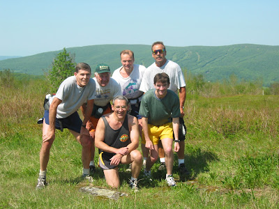
Saturday, June 3, 2017

Took a drive to Granville State Forest, with the intentions of refreshing my memory with the Ore Hill Trail;  I've pieced together a marathon from Granville to Satan's Kingdom, with the Hubbard River Trail as the lead leg.  Ore Hill was a trail I was familiar with 15-20 years ago, so I thought it would be a good day to check.

Traveled along Route 20 to Coe Road, and spent a few moments at the marker for Milo B, who died at this location in 1854.
Milo B Coe Marker

After speaking with the two DCR staff in the Headquarters for a few minutes as I was grabbing a trail-map, I noticed a "new" trail on the map (well, new to me as its been a while since I visited here).  The J&D Hewitt Trail appeared to follow the Hubbard River north for a bit, and then dead-end according to the map.  I followed it, and at this point I won't recommend using it.  The beginning is grown in with high grass, and the route follows what may have once been an old logging road, before stopping.  No signage, but the Hubbard River is pretty nice up this way.

Turn around point on the J&D Hewitt Trail

After getting my feet wet crossing the river, I bushwhacked toward Ore Hill Trail and enjoyed some old stonewalls and other stonework.

Maybe a balanced rock? Just needs to be cleaned up underneath?

Ore Hill was muddy and miserable, even after the intersection with Hayes Road and the climb.  Prior to that, I explored some bike trails north of this area, but both ended up in backyards.  Neither are good enough to re-visit.  Once on the top of Ore Hill, and the descent, the trail was better, but still wet, rutted, and being used for ATV's etc.  My initial choice of Hubbard River Trail will stand.  What is said about a first instinct is in fact true for me today.

Signage at the trailhead for Ore Hill Trail 

Once done, I had 8.7-miles on my legs.  More than I had anticipated, but it was only about 70-degrees with no humidity, so it seemed very easy.

Hubbard River flowing strong


Hubbard River Granville State Forest.... Part I & II.

Hubbard River, Granville, Massachusetts


Friday, June 2, 2017

I didn't leave work as soon as I had hoped, so my time this afternoon was limited.  I would take advantage of my "disadvantage" and drive to McLean Reservation, and climb up the Western Barndoor Hill.  I've wanted to climb the Western Barndoor Hill, adjacent to the McLean Reservation's Eastern Barndoor Hill, for about two decades but never followed through.  Today would be different.

The run up and back measured out at 1.2-miles, but at the parking spot along Barndoor Hill Road & Kettle Pond Lane there was a path leading east into McClean through the field.  After passing through a few open meadows, I intersected a trail I was familiar with, and made 3.2-miles out of the day.

Once home, I was surprised to get a call from my old friend Hill Billiage.  It had been a very long time since we communicated, and it was beautiful to catch up. 

From the acrchives department...  I completed my 11th marathon on this day in 1996 at Nipmuck.  I ran a 3:56:50 in the race, which was good for 15th place.

View north from West Barndoor Hill
 A view off  Barndoor Hill
 Granby Landtrust signage


Thursday, June 1, 2017

A bit of afternoon rain before a fantastic clearing of the skies...   I couldn't resist a trip to the woods for a run.  Had the McCann Farm parking lot to myself, and stuck to the Jerry Stage Trail and Shady Brook Trail for a nice 3-mile loop.

The gypsy moth  are really prevalent in this area.  We noticed them  on Monday, but today it seems like they were everywhere.  I ended up brushing at least 30 or 40 off me as I ran up the western portion of the Jerry Stage Trail.  The first couple weren't a bother, but honestly it was a bummer getting these things off my face, neck, head and arms.

I ended up at McCann due to K2 mentioning the difficulty he had on Monday, knowing where he was in relation to time.  I grabbed good gps coordinates and will get the entire McCann-Whitiker area  on one precise map.


Old News Department...

On this day in 1997 I completed my 14th marathon - Nipmuck.  It was the 3rd time I completed Nipmuck, and my time was 4:31:44, good enough for 42nd place.

Also, on this day in 2013, I completed my 49th marathon - Hawley Berkshire East.  I had Wuzzam with me for this one, which was a real beast.  We had a total time on feet of 7:45:15, which was the longest either of have ever been on our feet moving through the forest.  It was most likely more than a marathon distance.  By several miles...  (or more).


In the way-back department, from June 1st, 2002 (fifteen big years if you want me to do the math), a group of Adams-Boys and a few others tackled a long run on Greylock.  By the look of the pictures, I can recreate out steps... it was a longish day judging by the snapshots.

The Group at Jones Nose
Climbing Jones Nose
Rest Break after the climb
Billy leading us through CCC Dymanite Trail
 Another Rest Break
 Deer Hill Falls
 A very young Trail Troll with Tippi

Wednesday, May 31, 2017

It looked like the severe rain and thunderstorms would happen late enough so that I could take a run in Cowles Park, East Granby between my normal work day and the evening meeting I needed to attend.  

It was crowded at Cowles, perhaps 20 or more mountain bikers rambling around the trails.  I grabbed a quick 3.2-miles on a sort-of loop, and felt satisfied.  Making my way back to running during the week is a challenge, between often longish work-hours and my energy.  So any time I am getting out, I celebrate it.

Kissing Trees


Tuesday, May 30, 2017

As the training improves, my fitness improves, and confidence grows.  The idea of a "marathon" is active in my mind.  My list for the near future is as follows, in alphabetical order:

2017 - 2020 Marathon Planning

Appalachian Trail  from Salisbury to Mt. Everett and back.

Ashfield Trails.

Bash Bish Falls and the South Taconic Trail.

Charlemont Trails & Berkshire East.

DAR State Forest.

Granville State Forest to Tunxis Trail thru to Satan's Kingdom.

Greylock Marathon. 

Hoosac Range.

Mahican Mohawk from Route 2 North Adams to Charlemont.

McLean Reservation including Holcomb Farm & possibly Enders.

Metacomet from Robinson State Park to Hueblin Tower.

Mohawk Trail State Forest, Negus, Monroe Bridge, and Monroe.

Nipmuck and Natchaug combo.

Robert Frost Trail from Mt. Toby to Wendell State Forest.

Shenipsit (Bald Mountain to Soapstone to Whitiker Woods).

Taconic Crest including the Snow Hole.

Yukon Ridge (Lenox, Pittsfield with BNRC trail).


Old Marathon News...

On this day in 2009, Wuzzam and I completed a McClean Reservation Marathon in roughly five hours.   This was my 39th marathon completed.  I recall it being a fairly easy day for us.

Monday, May 29, 2017

Out to Somers to Whitiker Woods, with K2 and Wuzzam.  6.6-miles prior to the predicted rain.  We ran into two friendly labs and one great big Saint Bernard.  The owners were friendly folks as well.

One thing that I am now aware of is the online maps for Whitiker and McCann are not truly reflective of what is built out there now.  I'll have to update something in ArcMap with all the trails for reference.

Initial Climb up a fern-lined path.
My favorite section of trail, slightly to the west of Shady Brook.
High point of the day, at 621'.
Wonderful stonewall lined trail; this area really is impressive.
Wuzzam at the sign, which we all thought was new.

Sunday, May 28, 2017

On my way to visit my folks, I stopped off on Route 116 in Savoy, to run a loop through Windsor along Bush Road, Upper Road, Ridge Road, Middle Road, Windigo Road, and Bush Cemetery Road.  Totaled up at 4.8-miles.

One of the old sites passed by was Camp Windigo, which seems to have been demolished since my last visit.  Here is some old information detailing it's history.

Part of this run has been used in the past when we would complete a Whitcomb Summit to Windsor Jambs run, or when the Wuzzam and I completed the Dunbar-Whitcomb-Jambs Marathon on September 7th, 2014.  Beautiful area, old roads somewhat grown in, part of Windsor State Forest and the old Camp Windigo.

Took a few moments to admire the Bush Cemetery, established in 1798.  Ended the day with a wonderful visit with the folks in Adams.

A look at the cemetery gate and sign
 A view of the cemetery including the old Maples
 An interesting rock, what kind of shape do you make it out to be?


Also on this day in 1995 I completed my 6th marathon, Vermont City.  I finished in 3:08, and qualified for the 100th runnig of the Boston Marathon.

Saturday, May 27, 2017

Took a drive to Barkhamsted, to Peoples State Forest, with hopes of completing a decently long route.  Finished the day with 11.2-miles, and plenty of climb.  I call it a success.

Along the way, I enjoyed the following:
  • I crested Ragged Mountain twice.
  • Dropped down to the Barkhamsted Lighthouse Village Archeological Preserve.
  • Climbed up the waterfall back to the Jesse Gerard Trail.
  • Topped out at the first peak on Gerard, with a fine view west and south.
  • Climbed over Chaugham Peak.
  • Continued through a passageway between two giant stones.
  • Visited Big Spring.
  • Passed by Beaver Meadow.

Start of the Journey over Ragged Mtn on the Elliot Bronson Trail
 Lighthouse Trail Head, part of the Falls Cutoff Trail from Jesse Gerard
 Waterfall toward the middle of the climb
 
 Top of the Waterfall
 First Crest of Jesse Gerard, view southwest with Farmington River
 View from the Top of Chaugham Peak
 Through the Passage
 An old Cellar Hole along Charles Pack Trail
 Route for the day

Friday, May 26, 2017

Visited the Metacomet on Route 20 again today, but went south to explore and hopefully connect side-trails.  Completed a little over 3-miles (3.2) and successfully followed the side-trails to re-establish with the main corridor.

I am puzzled and amazed by stonewalls going up or down a steep slope.


Thursday, May 25, 2017

Music 2017...

Here is effort #15, You Blister My Paint...

This was a song I wrote after reading "A Clockwork Orange" by Anthony Burgess, during the summer of 1984.

The Primitives played it fairly often, but this was just Skip and I upstairs at a church in Williamstown. I sang, played rhythm guitar and bass. Skippy delivered the organ and lead guitar.


Going back to this day in 2002, I had photographs from Bigelow Hollow State Park... 

The Old Goat, Cemetery Man & Wuzzam at Mashapaug Pond
Old Goat & Cemetery Man crossing the swamp (before re-route)
 

Wednesday, May 24, 2017

Another after work run, again on the Metacomet but from Route 20 in Granby.  Really nice night, and I stayed inspired enough to complete 3.7-miles.

Copper/Peak Mountain, with Hueblin in the background.
 An open view west through the trees.
 Looking at the quarry in West Suffield (Manitook Mountain).