Friday, June 15, 2018

Penwood today to see if I could catch the Mountain Laurel in bloom, as last year I totally missed it.  Took an alternative path I had remembered from years ago to the east, and for the last 5-miles stuck to the Blue Blazed Metacomet (or New England Trail) Trail.  Acutally,  that is somewhat true, as for the last couple tenths I moved off the Metacomet to explore a bike path.

I caught the bloom, but it looks like it might still be one-to-two weeks out.  I plan  on revisiting if the schedule allows.  Tired legs but rambled through for 6.3-miles.

Mountain Laurel in bloom along the Metacomet Trail

Mountain Laurel in bloom along the Metacomet Trail

Mountain Laurel in bloom along the Metacomet Trail


Thursday, June 14, 2018

Back to Cowles to run the "inside loops" somewhat hard.  After yesterday's jog, I thought one loop inside would be right at 3-miles.  I am not sure if I am wrong or not, but I ran fairly hard, and I ended with 2.6-miles on the gps.

But, I might not be wrong at all, either.  The "inside loops" turn back on themselves regularly, for the duration of the paths.  It is so extreme, that at times the gps actually tracks over itself.  I know from experience that under these conditions, a older gps is going to be 10% to 30% off.  The unit I use is newer, with much better accuracy, but the twist and turns are going to be an issue on a trail network like this.

The deciding factor for me is that running slightly hard had me finishing in 40:30, which is much too slow for my effort today.  I am not sure what the distance really is, and wont unless I wheel it or have someone with a mountain bike measure the route for me, but I am going to call this a 3-miler for reference sake.  Next time I ramble through this maze, I will attempt to break 40-minutes!

Wednesday, June 13, 2018

Visited Cowles Park for the 1st time this year (I believe).  There appears to be a trail I had not noticed during prior visits, just north of the parking area.  Total for the day, 3.9-miles.

Tuesday, June 12, 2018

3-miles along the Metacomet, from Phelps Road south.  Wonderful night, just about perfect.

Suffield Land Conservancy trail-head sign for "The Spencer Woods"

Not far from the trail-head, the hugging trees

Close up of the hugging trees

Monday, June 11, 2018

Continuing to track my "peaks", or at least "high points" along the trails I cover.

May's High Points:
  • "Nick's Hill", West Suffield Mountain / Metacomet Ridge
  • West Suffield Mountain, Metacomet Trail, Suffield, CT
  • Copper - Peak Mountain, Metacomet Trail, Granby, CT
  • Stony Hill, McLean Refuge, Granby, CT
  • Pine Mountain, Tunxis Trail, Barkhamsted, CT
  • Indian Council Caves, Tunxis Trail, Barkhamsted, CT
  • Monks Mound, Cahokia Mounds State Historic Site, Collinsville, IL
  • Trillium Hill, Tunxis Trail, East Hartland, CT
  • North Peak, Tunxis Trail, East Hartland, CT
April's High Points:
  • Stony Hill, McLean Refuge, Granby, CT
  • "Nick's Hill", West Suffield Mountain / Metacomet Ridge
  • Bartlett Tower Hill, Tariffville, CT
  • Pinnacle, Penwood State Forest, Bloomfield, CT
  • Skyline Overlook, Somers, CT
  • Rattlesnake Hill, Somers, CT
  • Minnechoag Mountain, Hampden, CT
  • Copper - Peak Mountain, Metacomet Trail, Granby, CT
  • Hart's Pond Hill, Agawam, MA
March's High Points:
  • Hatchet Hill, Granby, CT
  • "Nick's Hill", West Suffield Mountain / Metacomet Ridge
  • West Suffield Mountain, Metacomet Trail, Suffield, CT
  • Perkins Mountain, Somers, CT
  • Skyline Overlook, Somers, CT
  • Rattlesnake Hill, Somers, CT
  • Minnechoag Mountain, Hampden, CT
  • Stony Hill, McLean Refuge, Granby, CT
February's High Points:
  • Skyline Overlook, Somers, CT
  • Goat Rock and Lookout Point, Hampden, MA
  • Minnechoag Mountain, Hampden, CT
  • "Nick's Hill", West Suffield Mountain / Metacomet Ridge, Suffield, CT
  • Hill 880', Hampden, MA
  • Pine Mountain, Hampden, MA
  • Perkins Mountain, Somers, CT
  • West Ridge, DAR State Forest, Goshen, MA
  • Walnut Hill, Williamsburg, MA
  • Copper - Peak Mountain, Metacomet Trail, Granby, CT
  • West Suffield Mountain, Metacomet Trail, Suffield, CT
  • Merritts Hill, Williamsburg, MA
January's High Points:
  • "Nick's Hill", West Suffield Mountain / Metacomet Ridge
  • Bald Mountain, Shenipsit State Forest
  • The Pinnacle, Shenipsit State Forest
  • "Balanced Rock Hill",  Shenipsit State Forest
  • "Bent Birch Hill", Shenipsit State Forest

Sunday, June 10, 2018

K2 joined me along the Tunxis Trail this morning, we would work our way from Ratlum Road to Route 219 and back, a distance of 7.8-miles round trip.  

I suggest tackling  this section from the south and heading north to start.  There is fairly significant elevation change during this 4-mile stretch, and I've found it beneficial to take the easier north to south direction for the finish.

Mountain Laurel was in bloom, there isn't a ton of it flowering but those that did were impressive.  The trail is in decent shape, a few wet areas, but all-in-all one of my favorite sections of trail in Connecticut.

Top of Ratlum with Sign-In Log

View of Barkhamsted Reservoir

Mountain Laurel along the path


Additionally, this day has found me completing two marathons in my past.  In 2001, I completed my 23rd marathon at Nipmuck, in 4:27:17.  This was a 35th place, and my 5th completed Nipmuck.

Then, on this day in 2012, Wuzzam, Tippi and I completed a Tunxis Marathon in 6:26:10.  This was my 45th Marathon, and Tippi's 16th.

Saturday, June 9, 2018

Seeing as I am feeling well, and the day was free, a trip to Hawley/Dubuque to continue building distance training seemed to be a good idea.  Wuzzam was in, so I had a partner.

We hoped to complete something in the 12 to 16 mile range, and be under 4-hours.  We accomplished those goals with a big loop broken into three small loops, if that makes any sense.  I didn't realize the route involved three smaller loops until I looked at the map afterward.

We caught some neat things on our adventure...  we passed by the Balanced Rock off the Bog Trail without checking it out this time, but later on through the woods another was spotted!

Camp Rock Trail was in fantastic shape, and from Gould Meadow we navigated some of the Gould Trail south, and it is filling in nicely from the logging done there years ago.  There are some very tall white pine at the southern end.

Hunt and Hallockville Roads have been repaired through the forest.  I like what I see, and I hope it ends up being a "good thing".

By the end, we tackled 14-miles in a bit over 3:30 running time.  Cool day, no humidity, mosquitoes were brutal whenever we stopped.

New sign at the Fire Department / Kiln Parking area

Growing out of the "Notch"

Wuzzam at the "Notch"

Aunt Charity's Chair

I thought this was a balanced or perched rock

Perched Boulder just south of prior formation

Perched Boulder

Perched Boulder

Perched Boulder

Perched Boulder

Camp Rock

Camp Rock

Ring Trail at Beaver Pond

Bent Tree Limb along Snowshoe Trail

Twisted Beach at Snowshoe Trailhead


Friday, June 8, 2018

Another really decent day, and after physical therapy I drove to Tunxis State Forest to check on a side-trail I had viewed on my May 29th run.

After a short path to a view of Emmons Pond, I climbed from Hurricane Brook Road east to Pell Road.  These are ATV / Snowmobile trails most likely, and can be advantageous for my circled world theory.

I jogged north to the trail head I used on May 29th, which dropped down to the Hurricane Brook Shelter along the Tunxis Trail proper.  Having made that connection, I began back, but ventured off Pell Road into the woods on an old path.  It re-connected further south along Pell, but there is a trail heading east at the height of land.  An exploration for another day!

3-miles in virtual slow motion, but enjoyable nonetheless.

Emmon Pond

Emmon Pond

Emmon Pond

Large Rock Formation off Sidetrail to Pell

Thursday, June 7, 2018

I made it out as the sun was setting for 3-miles along Main Street.

And, two throwbacks today...

On this day in 1998, I completed the my 4th Nipmuck marathon in 4:28:33, a 41st placement.  This was my 18th finished marathon.

Also on this day, in 2009, I completed my 7th Nipmuck Marathon in 4:37:03 (a fantastic 19th place).  This was my 40th marathon overall.

A great marathon day in my history!

Wednesday, June 6, 2018

Music 2018...

Effort #24, The Modern Lovers "Roadrunner".  Another cover by the Primatives in 1984, the full band version (Farmer, Aldo, Lee, DL & Skippy) live on Burlingame.

Third times a charm on this one, as I've recently posted two other versions.  This one starts off sounding like "Sister Ray", but at about the 1:20 mark Lee drives this thing into overdrive.  Her drumming was incredible, and we kept up the pace.  I especially like Aldo yelling "Ok... you sing it Eddie" toward the ending.

"... Got the Power Got the AM."


On this day in 2010, I ran the Nipmuck Marathon for the 8th time.  It was my 44th marathon completed, with a time of 5:07:28.  This was good for 34th place overall.

Tuesday, June 5, 2018

Legs are a bit tired from the race Sunday, but it was a really nice day, and really cool temperatures, so I drove out to the West Suffield Bike Path (Farmington Canal Heritage Trail & Farmington River Trail) to jog a slow and easy 3-miles.

View from the Parking Area of the Metacomet Ridge

Old accomplishments ~~

On this day in 1994 I completed my 3rd marathon - Nipmuck.  It was my first Nipmuck Marathon completed, and my time was 4:02:00, good enough for 23rd place.

Also, on this day in 2005, I completed my 25th marathon - also Nipmuck, with a time of 4:48:13.  This was good for 29th place.

Monday, June 4, 2018

Afternoon meeting at SCA Americorps at Dubuque State Forest in Hawley, Massachusetts with Dubuque / Hawley State Forest Stakeholders.  Really good turnout, representing many multi-use groups.  

I've done some mapping in the past, trail monitoring, and of course multiple snowshoe events within the forest.  And, of course, I've just been a "visitor".

One thing suggested was starting a "Friends" group for this forest.  I hope to be involved.

Sunday, June 3, 2018

Wuzzam asked me to go to a race today, the Goodwin State Forest 30km.  I don't think I've been to a trail race since Nipmuck Marathon 2012 and Goodwin 2014, so this was a pretty big leap for me.

The weather looked really promising, basically nothing worse than mid-seventies with no humidity.  Because of this forecast, on Saturday night I told Wuzzam that I would be about a 25% chance of making the start line.  He said he wouldn't spend too much time looking for me then.

Goodwin is a special place for me, I have done my naturalists training there, and I think very highly of  the Friends who support the forest.  If I was going to run a trail race, this should be one of my first choices anyhow.  I was plenty familiar with the trails, as I had done the 1st Annual Goodwin 30k back in 2014, and I've usually run after the naturalists training.

So, I woke early enough to take the 50-minute drive and register for the event.  I was eligible for the "geezer" discount of $28 race day.  The race began after a pretty lengthy introduction by the race director, and I found myself well at the back of the pack.  One reason is that I haven't raced, and I am slow.  Another is that the race includes a 10 km version, which has about double the participants of the 30 km, and those runners took off quickly.

I remembered many of the trails and most of the landmarks along the way.  I ran steady, without any walking at all, and had no mental fatigue whatsoever.  My ankle felt fine the entire day, as did most everything else.  No complaints on this beautiful day.

I had run this event in 2014 in 3:37:36, which was good for 18th of 37th place.  Today, I managed 3:49:25, and 19th of 40-finishers.  Interestingly, I was passed with about 10-feet to go, which knocked me out of 18th again.  I have confidence that I am not far away at completing a marathon due to the fitness I showed today.

I was reminded today why I stopped racing a few years ago...

1) Having to arrive an hour early (or more) to do a run.
2) Paying an entry fee to do something I can do on my own.
3) Having to be at a certain place, at a certain time, and then depend on the event to be on schedule.
4) Crowds for the first several miles, havoc for the footing and rhythm.
5) At some point, despite best intentions, it becomes a race.
8) Like it or not, effort and speed tend to pick up at a race, which makes recovery longer.

On the plus side of things, the advantages I can think of are...

1) Water Stops and Aid Stations equipped for us at sensible locations.
2) A better work out than "just being out there" alone.
3) Awesome volunteers.
4) Supports a "good cause".
5) Trail Runners tend to be friendly, positive people.

One thing I noticed back at the last Nipmuck Marathon I did, and it was true again today, is that I didn't really know more than 4 or 5 people at the entire event.  During the 1990's and 2000's, I actually knew and spoke with 50 or 60 regulars at any of the dozen or more trail races I entered.  It seems like many, like me, have decided racing wasn't for them any longer.


Saturday, June 2, 2018

Took a drive out to Williamsburg / Conway for an attempt at locating a plaque set in a large stone commemorating The High Street Walking Club and Edward C. Gere, circa 1926.

I've made minimal attempts at locating this monument in the past, but haven't succeeded.  Today, I was armed with some added data from a geocaching site, and felt pretty confident regarding the  available directions.

The parking area is along Nash Hill Road in Williamsburg.  In the psat it had been possible to come up from the east on Williamsburg Road, but the bridge has been out the past few years so no go.

This is active watershed land managed by the City of Northampton, and the old country road named "the Henhawk Trail" connects to Conway State Forest.  The main trail/route, as well as several side-paths, are utilized by local snowmobile clubs during winter.  There are numerous, lengthy stonewalls crisscrossing the forest - often climbing steeply uphill.  There are also some hard to locate single-track trails such as the route leading to the Williamsburg Wonder (balanced rock, see my post from May 19th, 2017).

Roughly 1.2-miles north on the Henhawk, where the trail finally changes to "downhill", I began a bushwhack along a stonewall heading west.  It was a easy to follow the stonewall, but it is pretty steep hiking.  Finally, I arrived up at the top, and was surprised to find the memorial plaque set in a large stone at the convergence of three stonewalls.  This feels like a really strong spot.

From the plaque, a single-track trail headed north, but after a quarter to a half-mile it seemed gone.  There was a decent amount of blow-down, and obviously this hasn't been a regularly used trail in many years.  After the first light snowfall would be a helpful time to re-explore to see if the trail could be more easily followed.

I bushwhacked north, passed by a really nice vernal pool (or actual small pond), and finally re-entered on one of the forest roads I was familiar with.  Managed to ramble my way back with 4.7-miles on my legs.

Finding the plaque was a goal for 2018, and the array of stonewalls meeting up with the location is something I need to take a look at with some LiDar data.  The undulating wall heading south is of interest to me.

Excellent day, even with the bugs being brutal and the humidity a burden.  I hope to be back in early winter to this location - to revisit the balanced rock and hopefully bushwhack from that trail to the marker following the undulating wall.

High Street Hiking Club dedicated to Edward C. Gere, 1926

This stone is the meeting place for three stonewalls

The stonewall heading south, downhill, is an undulating network

The Henhawk Trail includes an abundance of stonewall & interesting stacks

An interesting "kneeling tree"


From the archives department...  I completed my 11th marathon on this day in 1996 at Nipmuck.  I ran a 3:56:50 in the race, which was good for 15th place.

Friday, June 1, 2018

A little warm and just after the rain had fallen, the 3.7-miles along the Metacomet Trail south from Phelps Road was a welcome today.  It felt really good to enjoy the woods and loose my mind for a little bit of time.

The forest has really "greened up" since last week

Old News Department...

On this day in 1997 I completed my 14th marathon - Nipmuck.  It was the 3rd time I completed Nipmuck, and my time was 4:31:44, good enough for 42nd place.

Also, on this day in 2013, I completed my 49th marathon - Hawley Berkshire East.  I had Wuzzam with me for this one, which was a real beast.  We had a total time on feet of 7:45:15, which was the longest either of have ever been on our feet moving through the forest.  It was most likely more than a marathon distance.  By several miles...  (or more).


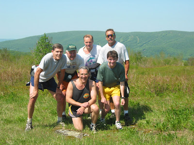
In the way-back department, from June 1st, 2002 (sixteen big years if you want me to do the math), a group of Adams-Boys and a few others tackled a long run on Greylock.  By the look of the pictures, I can recreate out steps... it was a longish day judging by the snapshots.

The Group at Jones Nose

Climbing Jones Nose

Rest Break after the climb

Billy leading us through CCC Dymanite Trail

Another Rest Break

Deer Hill Falls

A very young Trail Troll with Tippi