Thursday, July 26, 2018

It has been difficult during July, with the warmth and humidity.  Today was no different, but I managed a trip to McLean for 3.7-miles.  The run included a visit to the tall 140' white pine near Spring Pond, and a climb to the east Barndoor Hill.

Stone Pile atop East Barndoor Hill

View west off East Barndoor Hill


From the archives...  Fifteen Years ago today (July 26, 2003), camping at Windsor Jambs, visiting the Windsor Bush Cemetery, the Jambs, Savoy for hiking and a swim in Burnett Pond, haying on Burlingame, and  back to the tent and fire along the Westfield River.

Windsor Bush Cemetery

Windsor Bush Cemetery 

 Windsor Jambs

 Me, JC, and Tips in Burnett Pond after a Savoy Mtn hike

Pop with his bailer

Mt Greylock in the background from the childhood home

Pop says "Hi"

I sure do miss tent camping at Windsor Jambs, right along the stream

Enjoyable fire to cook on

Wednesday, July 25, 2018

More Black Lizard / Vintage Crime reading progress...  completed Dashiell Hammett's "The Maltese Falcon".  This is a very old novel, published in 1930.


Tuesday, July 24, 2018

Old news department...

On this day in 2009, Tippi and I explored the Robert Frost Trail through Sunderland and Amherst (I think).  It was a day after a really hard rain, so the brooks and streams were really roaring.  We ended up losing a bunch of time "off trail" around Eastman Brook.

We parked at Amethyst Brook and did a bit south, then north to the foot of Bull Hill.  Outstanding area that I would like to return to.

This was my 41st completed marathon and Tippi's 14th.  The run took us 6:03:58 to finish.

Monday, July 23, 2018

Music 2018...

Effort #30, Solo attempt at the Cars "Since You're Gone"...  I remember loving the drums when this came out, but as I revisited it lately I really dug the words.

"Since you're gone, the nights are gettin' strange...


Sunday, July 22, 2018

Visited Mt Tom Reservation early this morning in the pounding rain.  Wuzzam's knees took a beating on the descent off Mt Tom on Friday, so I wanted to check for alternative ways down to Whiting Street Reservoir.

I found what I was looking for at the north end of the reservoir, and then churned my way up the old road past the B-17 Memorial sight.  Just opposite the Memorial, there was a trail heading back south which "looked" correct for what I was hoping to accomplish.

The trail re-connected with the Metacomet, at a spot I recognized easily enough.  The next exploration will be to connect some of Mt Tom's trail network to Little Tom, and then get over to the B-17 Memorial Road.  I believe it will be possible both high and low, so I have some work to do in the future.

The rain stopped about half-way into the run, which ended up at 5.1-miles.  


Saturday, July 21, 2018

An enjoyable recovery run in McLean Refuge today, good for 3.7-miles.


Friday, July 20, 2018

Wuzzam agreed to run the Mt Tom ridge with me today;  he wanted to go away from Connecticut to avoid the gnats and deerflies that have hounded him lately.  He was up for going somewhere he had never been before.  I explained that the Mt Tom ridge, using the Metacomet-Monadnock Trail (the New England Trail now-a-days I guess), was beautifully scenic and would help us develop our climbing legs.

We managed six peaks today, as follows:

Mt Tom @ 1202'
Dead Top @ 1110'
Whiting Peak @ 1014'
Goat Peak @ 822'
Dry Knoll @ 835'
Mt Nonotuck @ 827'

We also visited the location of the Eyre House Ruins.

The Metacomet, especially from Mt Tom to Whiting Peak is open ledge running and very scenic.  The views from Goat Peak onward are also rewarding, especially of the Oxbow.

We took the McCool, Dynamite, Keystone, and D.O.C. Trails in addition to the Metacomet for the return trip.  By the finish, we were pretty well baked.  Completed 13.5-miles, with the open running tough with temperatures in the 80's.

Close to the Peak of Mt Tom

Along the Ridge

Along the Ridge

Along the Ridge

The Oxbow in the Connecticut River

Below Goat Peak

A balanced rock along the route

Along the Ridge

Along the Ridge

Climbing along the Ridge

Climbing along the Ridge

Wuzzam at the "big rock"


Thursday, July 19, 2018

I set a goal of visiting twelve Williamsburg Woodland Trails this season.  There were not twelve sites within the Williamsburg Woodland Trails Properties, but there were some that subscribed to the same type of designation, and were in the area.  The twelve properties are as follows:
So I have managed to visit 8 of 12 so far, which is just ahead of the one-per-month pace I originally thought of.  

Today, I rambled through 5.2-miles through Williamsburg Woodland Trails, in the Hall/O'Neil and Graves Farm Properties.  


Much to recommend within both properties, with Hall/O'Neil extending down into the town of Williamsburg, and Graves looks as though it might offer something extending toward town (I'll need to explore more later on in the year).  


Graves also shows a "connection" north toward snowmobile trails along Grass Hill Road, which connects to the Henhawk area (and a trail I snowshoed years ago with Tippi).

Entrance to Hall / O'Neil Trails

Trail along the brook at Hall

Entrance sign for Graves Farm

Plaque on rock at Graves Farm

White Pine along the trail at Graves Farm


Wednesday, July 18, 2018

I was thinking Penwood or Talcott Mountain area today, and then I remembered some trails I noticed on "open streetmap" underneath Penwood's Metacomet Ridge.

Found a nice little clear grass parking lot, Simsbury Land Trust's "Tanager Hill" area, that would lead to the trail network.  Followed the Owen - Mortimer Trail up to the powerlines, and then took the spur to meet up with Penwood between a lookout and Lake Louise.  Came rolling down, around a meadow and pond, and then down Lucy Brook to the parking area.  4.3-miles of enjoyment in a beautiful area.

Also, on this day in 2008, I completed the Hallockville Pond - Mt Institute Marathon with Wuzzam and Tippi.  The 25+ miles were completed in 5:29:07, and ended with a dip in Hallockville Pond.  This was my 36th completed marathon and Tippi's 12th.

Looking off the Metacomet Trail in Penwood State Forest

Tanager Hill Plaque along Lucy Brook

Kiosk in Parking Area

Tuesday, July 17, 2018

Music 2018...

Effort #29, Dark Heart Duo... "Calm After Storm".  This was Evil's first drumming of 2018, and I pieced together some guitar sounds after the tremendous rain and wind event tonight.


Monday, July 16, 2018

Music 2018...

Effort #28, The Road Warriors for Christ... "Blister My Paint".  An original I wrote back in the Primative days, 1984.  This time, it's just me and the Reverend, 1988, in Bedford, Texas.

"... what was it anyhow, something that I said?"


Sunday, July 15, 2018

Another hot and humid day, and to top it off, I didn't do a very good job of getting out early morning.  It was difficult for the last two of the 5.1-miles in McLean Refuge.

Snake Skin, with my size 15 sneaker for reference


Saturday, July 14, 2018

Continuing with visits to the Tunxis Trail, K2 and I got an early start at Route 219 with plans to run north.  I hoped to make it to "Old Route 20", which is a Reservoir Road now, and it is located just shy of 8-miles from Route 219.

It was brutally humid for a "coolish" day.  I was absolutely drenched within the first mile, and it got much worse from there.  I don't think it even made 80-degrees while we were out there, but the drain on my body was extreme today.

Knowing how I was feeling, I made my trip a bit easier by using a bit of road from the half-way point, for a mile or so.  Truthfully, this was also done to avoid looking at the massive clear-cutting of the forest about a mile out from "Old Route 20", which the State of Connecticut calls "Hemlock Salvage".  This is particularly disturbing to me as this was truly a beautifully peaceful section of the forest.  It also contained a side-path we used often throughout the years, to connect to the Roberts Brook Bypass (which I caught today on the dead end Pine Road).

Having attended the Old Growth film and lecture on Tuesday, and hearing the truth about the value of old growth and old trees with regard to carbon sequestration, it really seems counter-productive to harvest so many older trees.  I encourage any and all to begin to pay attention to the value of trees, forest, and the environment each and every day.

So, getting beyond that it looks awful to ramble through a cut forest, and we as a population may not be doing a very good job of managing our forest, I also have a reminder of what these forest looked like in their most recent natural state in my mind.  I have memories that I don't want to let go of, moving slowly through the rolling terrain of Tunxis with my dog bounding off on a shortcut to meet up with me later on.  

It would be fine with me if I could still experience these memories while in the woods, rather than revert to cognitive memory because the woods as I remember no longer exist.  I think about the The “7th generation” principle taught by Native Americans says that in every decision, be it personal, governmental or corporate, we must consider how it will affect our descendants seven generations into the future.  So that the pristine sky, field and mountains will still be here for them to enjoy.

By the end, I managed to get back to the car and meet up with K2 with 14.7-miles on my legs.  I suffered a bit today, but to run wild through Tunxis was worth the fatigue I'll feel over the next couple days.

Wolf Tree along the route


USGS marker for Pine Mountain


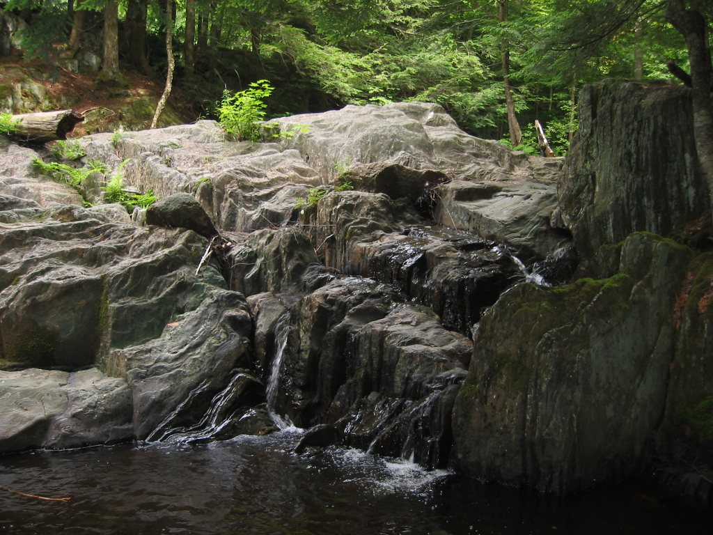
Roaring Brook Swamp (headwaters?)


The top of Pine Mountain on a hazy, humid day


Friday, July 13, 2018

Tunxis area to check on a side-path off Pell Road, I've been wondering where it went.  It didn't go far, just a turn-a-round / party spot after 1/8-mile or so.

Followed Pell Road into Massachusetts, to the field north of the Tunxis Trail, for a total of 6-miles.


Thursday, July 12, 2018

Made it out to Main Street in the evening for 3.0-miles.

And, from 15-years ago today, July 12th, 2003, camping in Savoy Mountain State Forest...  I sure do miss camping and all the fun that goes with it...

View from Cabin #2, South Pond

JC and Tips getting the evening fire started

 DL in a cloud of campfire smoke