Saturday, July 23, 2016

The heat hasn't left Connecticut yet;  Tunxis would be a little more elevation and hopefully cooler temperatures for Wuzzam, K2 and I.

It's a good thing that we left our old dogs home, because all the water holes they usually would frolic in were dried up.  The big pool on Kettle Brook and the camping spot along Roaring Brook were dry.  The swampy area at the height of land a mile in was dry.  The deep pool on the east side of Pine Mountain Road was very shallow.  Tough conditions this summer.

We managed just under 9-miles, an out-and-back with a loop on the end for Pine Mountain.  On our feet running for 2:09, which felt good in this heat.  Indian Council Caves and Pine Mountain were the focal points of today's run.

View northeast off Pine Mountain.

Looking toward Indian Council Caves.

Wuzzam making the climb to the top of Indian Council Caves.


Friday, July 22, 2016

Very hot today, temperatures appeared to reach 100 on the drive home from Cowles Park.  Third Friday in a row for K2 and I;  4 tough miles in the heat.

One of several Stone Walls throughout the loops.

Awesome bench where I sat exhausted after finishing my run today;  It had my name on it.

Monday, July 18, 2016

On this day in 2008, I completed the Hallockville Pond - Mt Institute Marathon with Wuzzam and Tippi.  The 25+ miles were completed in 5:29:07, and ended with a dip in Hallockville Pond.  This was my 36th completed marathon and Tippi's 12th.

Sunday, July 17, 2016

Still too hot to run long (for me, anyway).  Did an "old reliable" close to home out and back along the Metacomet in West Suffield, Connecticut.  Total of 3.5-miles.

 This northern section of the Route 20 to Phelps Road section offers some great views.

 Just above the sign in log.

Looking about 15 miles south to Hueblin Tower and Talcott Mountain.

Black Birch from possible "nurse log" .

Saturday, July 16, 2016

Played a little more music in the morning with Jon Bon Evil; It's still brutally hot and humid, so my motivation / energy has been strained.  I had seen a couple side paths off the Metacomet in Tarrifville last week, heading down toward Wilcox Park.  This would be as good a day as any to explore those and not overdo it.

The trails off Metacomet are not long, but they are interesting and nicely built.  On a run, they will offer up a nice option of a loop to connect back.  Wilcox Park was empty;  the grass was moved and the park was clean.  I have no idea what the rest of it looks like, but there was a small picnic area and a portable toilet available.

Ended up with 3.5-miles, incredibly slow.  It was plain hot.

View without last week's fog.

Friday, July 15, 2016

Second Friday afternoon in a row to Cowles Park, this time with K2.  Basically the same route as on the 8th, with a minor diversion to grab some trail coordinates I'd been missing.

Ended with 3.8-miles in 54 minutes.  The heat and humidity were extreme, but I didn't push at all either, so no idea if it was conditions or me.  Most likely a little of both.

Excellent trail network, nice dark forest, and easy and quick to get to.  This spot is a keeper.

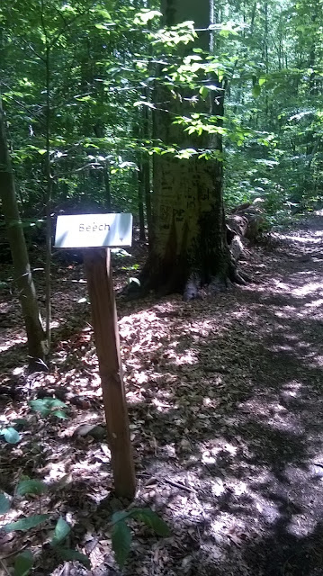
I am a really big fan of the tree id helpers along trails.

Large Beech along the trail.
 

Smaller Red Maple on same path.

Updated Map, showing inside the "Yellow Trail" within the park.

Sunday, July 10, 2016

Temperatures today were cool enough, in the high sixties and low seventies, but there were low clouds and rain threatening...  so it was very humid running.  Other than a few raindrops, I did not get wet from outside in.

Rambled along the Metacomet Ridge from Phelps Road in West Suffield to Route 20 in East Granby.  I've been on this ten-mile out and back too many times to count.  It's a good gauge of fitness;  first, can the entire thing be run without stopping for breaks, and secondly, how quickly can it get covered.

I had no trouble making the distance, but a sore left heal (woke up with it yesterday) really slowed me.  Might be a bruise, or the start of plantar fasciitis.  

Heavy clouds sitting in the lowlands.

Snake Skin shed along rock.

An hour into the run, and the fog is getting worse.

Today's 10-Mile Route (out and back).


Saturday, July 9, 2016

A busy Saturday morning at work, followed by a wonderful run along the Metacomet.  From Route 189, at the Farmington River, I passed through Tariffville and rose to the ridge, letting it carry me toward Penwood.  From there, I ventured into Wilcox Park a bit, and followed the trail to the Pinnacle at the height of land in Penwood.

This is a pretty nice section, if the gravel road enhancement could have been avoided through one short ridge-top section.  I am not sure why it continues as far as it does, but the stones are assimilating into the earth some over the years, so it isn't as bad on my feet.

Finished up with 8.3-miles in a little under 2-hours.  Once home, I was presented with a thoughtful gift from Donnalee, a tee shirt emblazoned as shown below:


Yes, I am a huge fan of Game of Thrones, books and television.  And, I dig that Hodor a great deal.  

As an added bonus, after receiving the tee-shirt, the phone rang and it was our old friend Johnny Bandit, who we hadn't heard from in many, many years.  What a day!

Just after the start, on Route 189, a view from the bridge (Farmington River). 

The Bartlett Tower, just a few tenths into the Metacomet Trail off Mountain Road.

One of the views off the ridge, looking west.

Today's look off the Pinnacle in Penwood, towards Hueblin Tower.

This old chimney used to be along the Metacomet;  the re-route goes away from it.

Friday, July 8, 2016

The rain never came, so it was a really great opportunity to get to Cowles Park after work.  K2 and Jon Evil joined excitedly, since neither had ever been to Cowles before.  They both finished up their tour impressed.

Took the inner-loops, and realized that the big intersection at the Shagbark Hickory would be a comfortable turn-around (1.8-miles).  This worked well with my hope of getting in about 3.5 total.  The route will be a nice way to get in some speed-work when there isn't time to go longer.

Jon navigating the turns.
 

 One of the small climbs.

K2 Finishing Up.


Tuesday, July 5, 2016

Scheduled off-day at work, so I had a brief 2-hour shift.  Afterward, back to Cowles Park in East Granby to see if I could locate the "other" climb to Hatchet Hill, more northerly.

The alternative climb was found fairly simply;  what I didn't expect was the incredible maze of "inner" trails within the park...  I never expected such back-and-forth and winding.  Wonderful surprise!

All told, 6.6-miles today after the heavy rain of the morning.  There were deerflies, but they were not too bad.  

Several bridges pop up throughout this trail network.

View from the top on Metacomet;  rain and clouds just thinking of moving out.

Mushrooms!

 Today's route is in "red".

Monday, July 4, 2016

Played some music with Jon Evil in the morning, so it wasn't until the heat of the afternoon that I ventured out to run.  Managed 3.5-miles along the Metacomet Trail from Hatchet Hill Road heading north toward Route 20.

I managed to take photos of several of the notable features along this section today, my camera was working ok.  The missed items mentioned on the June 26th, 2016 post have been corrected!

  
Large Oak along the path.


Charles Julian Kaiser's footstone.

Graveyard;  Deacon Joshua Holcomb, Ruth Ford, and Caleb Holcomb tombstones.

Joined Hemlock and Black Birch.

Sunday, July 3, 2016

The outstanding weather continued, so I managed another exploration in Cowles Park, East Granby, Connecticut.  Last weekend I ran a bit on the Metacomet in the Tarriffville area - and noticed dozen's of side paths.  About 15-years ago I had run from Cowles Park up to the Metacomet Ridge, and figured it was time to re-familiarlize myself with the area, as many of those side-paths lead easterly off the ridge toward Cowles.

The amount of mountain bike trails in here is staggering.  But, not only are there many, they are built really, really well.  As I begin to learn how it all connects, I imagine I'll visit here often.

Ended up with just under eight-miles (7.89), in about 1:45:00.  No bugs, No humidity, only minor heat today (about 80 degrees during the run).  I'd call it a pretty good day.

Cowles Park in East Granby, Connecticut.

The fight for survival.
  
Cowles Park has several educational Tree ID postings throughout;  this is Pitch Pine.

The view from above Tarriffville Gorge on the Farmington River.

 All the trails explored today;  I'll clean up a complete map once all trails are found.


Saturday, July 2, 2016

Spent the morning with K2 on the Tunxis Trail, between the two Ratlum Road crossings.  I intended to check on a the side-trails that have popped up over the years.

It was a magnificent day, about 65 degrees with a nice strong breeze coming up the ridge.  No humidity and bugs were at a minimum.  

Came very close to another Br'er Bear today, on the return trip on the last peak about 8/10-mile from the start (just prior to the Lake McDonough lookout).  I slapped the tree with the log-book attached, as I often do (no idea why), and Brother Bear was startled while half-way up a small black birch about 15' away.  The bear descended very quickly, which startled me!  I about-faced and took three big steps before turning back to see the bear was as disinterested in me as I was him.  Opposite direction at about 25-mph.  It was my third bear in the last three weeks, all very close, all big.

K2 and I managed 7-miles, and it went pretty easy.  The foliage along the Tunxis Ridge does not seem to be affected by the gypsy moth as Shenipsit area is.

First Peak heading north (about 8/10-mile), Brother Bear sighting.

 Second Peak, about 1-Mile out.

Interesting rock piles along the route.

Lake McDonough Lookout.

K2 wrapping it up.


Friday, July 1, 2016

My friend the Wuzzam hadn't run in 11 days, and wanted to "run about 90 minutes off Galbreath Road / Soapstone area".  Sounded fine with me.  The morning was much warmer than expected, and filled with humidity as well.  Additionally, Eastern Connecticut is seeing the worst gypsy moth caterpillar infestation in a decade, according to state officials.  The caterpillars are eating significant portions of shade cover.  Normally shaded "woods" are not so shaded this year.

We managed 6.5-miles on our legs;  we took a trail we hadn't been on, one that brought us up the eastern side of the Bald/Pinnacle ridge in a saddle between the two.  We noticed a few more paths we need to explore in the future as well.  The extensive time we've spent in this portion of Shenipsit really has helped us learn the terrain.  I'd say we're confident in here.

 Wuzzam and Zippy.
  
  
Wuzzam on a shelf, with two large set stones.
 
  Looks like a stone wall or maybe an old structure?