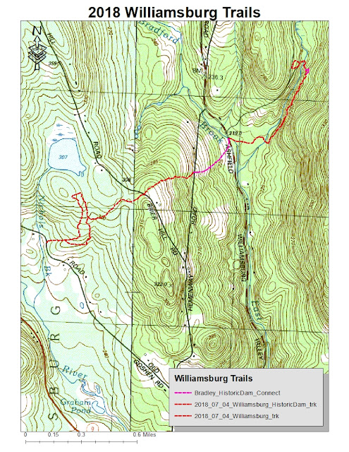
It's still very hot, but I had until noon for a bit of travel and a run. I drove to Williamsburg, Massachusetts to explore Williamsburg Woodland Trails "Historic Dam Trail".
The finished product is very nice, and rich in history. As I read the signage detailing the disaster of 1874, I was reminded of current events with similar stories. The short version is the dam was not built to original safety specs in order to save money. The disaster wasn't a surprise.
I enjoyed some time on a snowmobile or old logging path, which I'd used in 2016, but it was grown up a bit, so I bailed. Ended that portion of my day with 2.7-miles.
Realizing I still had some time (thank God for very early starts), I drove over to Old Goshen Road and the parking area of the Bradley Sanctuary. I wanted to see if the old snowmobile route was still something I could follow, as it actually used to end up across the street from the trail-head of the Historic Dam Trail.
Managed just fine, up to the road crossing at Briar Hill Road, and then to the next at Hemenway Road. The next short section, through one field, a skip through some woods, and then the final field along Ashfield Road, hadn't been mowed so I avoided. The old connectors are still intact.
Added 3.6-miles on this portion, so 6.3-miles for the day. Description below is from the Williamsburg Woodland Trails site.
Historic Dam Trail
On May 16, 1874, The Mill River Flood disaster claimed 139 lives and devastated the villages of Williamsburg, Skinnnerville, Haydenville and Leeds. The flood resulted from the failure of a dam which had been constructed by local mill owners three miles north of the Village of Williamsburg. The 600 million gallons of water that burst from the dam destroyed dozens of mills and houses and changed the appearance and the course of our town's history forever.
The ruins of the dam still exist today in the woods north of Williamsburg, but until now there has been no access to the site for the general public. Adjacent landowners and the Northampton Water Department (which owns the site of the ruins) have collaborated with the Trails Committee to develop a new pedestrian trail from Ashfield Road to the Dam ruins. The trail tells the story of the Flood and also the 250 year history of the Hemenway family farm and forest management in the Hilltowns.
As of Spring 2018 the new trail is complete! There are three footbridges, several plank bridges, a kiosk, benches, interpretive signs and trail tread improvements.
