It was going to be a fantastic day to be outdoors, and I needed a long-run. I also have been thinking about the Granville State Forest to Satan's Kingdom Marathon route I figured out a couple years ago (or so). I figured this would be an ideal day to verify distance of the first leg, which runs from Granville State Forest in Granville, Massachusetts to the Route 20 crossing on the Tunxis Trail in Hartland, Connecticut.
Section 01 would be from the Granville Forest parking area following the Hubbard River Trail down to North Hollow on Route 20 for 2.9-miles. This is a very scenic section, especially along the dozens of cascades on the Hubbard River. The section is basically downhill as well, so a nice lead in to a long day.
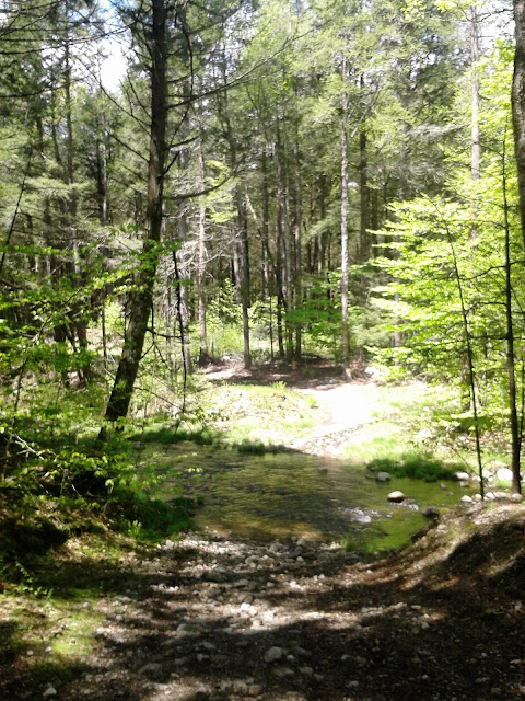
Section 02 carried me around the Valley Brook section, with a reverse of direction at Black Bear Crossing, total distance of 3.6-miles for this section, and a total distance of 6.5-miles. When I first explored this area, the path's were just old, soft dirt roads with grass growing in the center and edges. The last 15 or so years has been rough due to logging operations, and much stone has been placed on the old dirt. The canopy is missing as well, so the sun leaks through easily, so early morning is the best time of day (or later just before night).
Section 03 is a climb up the old jeep trail turned into logging area running just north of Hurricane Brook, meeting up with the Tunxis Trail at the lean-to shelter, and continuing to Hurricane Brook Road before the Trillum Hill climb. 1.2-miles for this slow section, with a total for the day of 7.7-miles.
Section 04, and my last of the day for the marathon route, is the major climb along the Tunxis up to Trillum Hill and then down to Route 20, a 1.3-mile section with half of it being steep, slow, uphill. The stop at Route 20 checked right at 9.0-miles - same as my old notes mentioned.
From here I took the jeep-path around the State Garage, to Hurricane Brook Road, and followed all the way back down to Route 20 again. This was on dirt and paved (believe it or not) forest road for almost 2-miles. Hurricane Brook has many wonderful cascades as well, not as "big" as Hubbard Brook, but really nice as well. This section is nicely shaded, and pretty much all downhill.
There is one area along Hurricane Brook with a small waterfall/cascade and a nice swimming hole below it. In the old days, Liddy, Tippi and Sam enjoyed cooling off within that wonderment.
Out to Route 20, ran along the shoulder for just under a mile to get me back to North Hollow parking area at 11.71-miles, and all that was left was the 3-miles back up along the Hubbard River Trail. Ended it up with 14.7-miles in 3:08 (4.7 mph average). A very satisfying run.
Monument to Milo B, Coe
Black Bear Crossing at Valley Brook
Feeder Stream to Hurricane Brook on the Tunxis Trail
Feeder Stream to Hurricane Brook on the Tunxis Trail
Trillum Hill, Tunxis Trail
Gorge on Hurricane Brook
Cascade on Hubbard River
Cascade on Hubbard River


