Wednesday, July 26, 2017

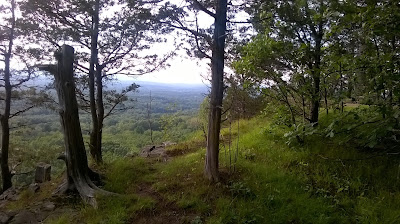
Just enough time between leaving my normal work-day and re-arriving for the scheduled monthly meeting to get in a 3.4-mile run on the Metacomet from Phelps Road.

This is an out and back that I've done way, way over a thousand times.  That I continue to visit it speaks to its appeal.

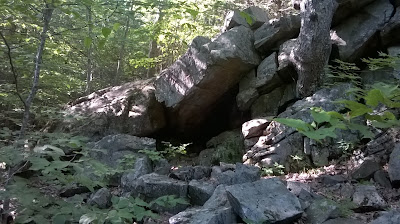
Chimney remains about a half-mile out from Phelps Road

Tuesday, July 25, 2017

Music 2017...

Effort #22, Tale of a Broken Man...

The Road Warriors for Christ, from the fall of 1988. Another original song of mine, lyrics and music.  The song is about a close friend, in need of redemption/salvation.  He found it.

The Rev. King supplied the lead guitar parts;  it was the first time I played the song with him.  His melody fits really nicely and engaged the mood of the song.


Monday, July 24, 2017

Old news department...

On this day in 2009, Tippi and I explored the Robert Frost Trail through Sunderland and Amherst (I think).  It was a day after a really hard rain, so the brooks and streams were really roaring.  We ended up losing a bunch of time "off trail" around Eastman Brook.

We parked at Amethyst Brook and did a bit south, then north to the foot of Bull Hill.  Outstanding area that I would like to return to.

This was my 41st completed marathon and Tippi's 14th.  The run took us 6:03:58 to finish.

Sunday, July 23, 2017

Had a 9:00 a.m. run planned with Wuzzam, with plans to tackle Penwood and Talcott Mountain in a loop, more or less.  

We rolled through 12.5-miles of rocky ups and downs, and we did so pretty successfully.  By that, I mean I felt as though I had another hour of running in me (at least).  Wuzzam thought he finished well, and had a bit more in the tank also.

We ended up at around the 3 hour mark for moving time.   Much of the route is rocky, and constant up and down especially the first 3.3-miles from Wintonberry Road to the Penwood parking lot.  This will be the final leg of a planned marathon, beginning in the north...  hopefully this fall.

Wuzzam at the Prayer Garden in Penwood
Hueblin Tower
Wuzzam at his first visit to Hueblin Tower / Talcott Mountain
 Just south of the Tower on the open ledge

Saturday, July 22, 2017

Broad Hill Road in Granby, Connecticut, off Route 20.  There are trails throughout the Granby Land Trust, Holcomb Farm, and McLean Game Refuge.  Wanted to get in a mid-distance run, and I hadn't been out in this area in a while.

The thing that pops into my mind every 5 or so years is a connection to Enders State Forest from the Broad Hill, Weed Hill and Pine Cone area.  I keep looking every half-decade, but so far no one has connected things for me.

Along this run, there are many "highlites"...
  • Cellar Holes & Stone Walls
  • At least One Old Well
  • Carpenter Falls
  • Pine Cone
  • Diamond Ledge
I managed 7.8-miles, in a remaining high humidity.  I did find some "private" trails off Broad Hill that lead into backyards, and one that loops about and catches a nice pond.  I did not see anything promising off the Pine Cone, so I'll keep those points on my gps and hike up from Enders sometime soon.

I cut off toward Pine Cone, but Broad Hill continues west.  It used to come out on Case Street, I'll check on that at some point.  There was also a single-track trail leaving Broad Hill to the south, which also came back around to Case Street at a Horse Rescue Farm.  Its been ages since I tried either of those options.
Carpenter Falls
 Carpenter Falls again
 Pond off Broad Hill
Remains of an Old Well
 View off the northeast side of Pine Cone
 The Summit of Pine Cone
 Diamond Ledge


Friday, July 21, 2017

Longish day at work, with a return necessary later this evening, but still time for a run along the Metacomet in Suffield.  Old faithful, Phelps Road south for 3.4-miles.

The far ridge is what I was on Wednesday and Thursday of this week
 Looking off the Metacomet down into West Suffield

Thursday, July 20, 2017

Back to the Cathles Trail with my gps.  The most excellent news is I got off the ridge and out of the woods just as the rain started.  And start it did, heavy and steady pouring sheets of rain that made driving difficult.  

I managed a track, and unfortunately did not see any "trail" leading up to the Westledge Trail of McLean.  At some point I'll try to come down off Westledge, near the cellar holes, to pick a line that can work.  I am always on the lookout to expand a run through the woods, and this ridge-line is really special.

2.5-miles again, with a couple of bushwhacks.  All in all, a real good day.

The clouds are rolling in overhead, with the Barndoor Hills in the background

Wednesday, July 19, 2017

After work I drove to the Cathles Trail in Simsbury, adjacent to McLean Game Refuge Property along the West Ledge Trail.  I had been along this ridge once before, in April of 2010.  To my chagrin, I did not have my gps with me today, so no waypoints or tracks to place on a map.  I just have my memory.

Once I get some points on a map, I am hopeful to connect this with the Westledge Trail in McLean, as it will really expand the circled world.  Even if a "connection" becomes a bushwhack.

For the day, I rambled for 55-minutes, so I'll be ultra-conservative and call it 2.5-miles (it felt strange not to run with my gps...)

Waterfall on the Cathles Trail
Small Cave at the intersection of the Cathles and the Red Trail
 View of the Barndoor Hills in McLean off the Ridge

Tuesday, July 18, 2017

Very humid today, and later at work than I had planned (again), but I made it to Metacomet anyhow to get out to the sign-in log and back for 3.4-miles.

Witnessed several broken trees due to the severe storms that have been rolling through the last week.  This one below is right at the sign-in log at the lookout.


On this day in 2008, I completed the Hallockville Pond - Mt Institute Marathon with Wuzzam and Tippi.  The 25+ miles were completed in 5:29:07, and ended with a dip in Hallockville Pond.  This was my 36th completed marathon and Tippi's 12th.

Monday, July 17, 2017

With my two ventures to the Holyoke Range area last week, it seemed appropriate for me to post an old piece written about 21-years ago, about the 7 Sisters Trail Race...

SIX PACK CHALLENGE

One of the first things to remember about running, especially in an event or race, is to run your own pace. Never ever let outside influences affect you. It is very easy to get caught up in the excitement of a big start, tearing off at suicidal speed only to suffer for it later. It’s also easy to get in a group and despite realizing you may be going a bit too fast, hang on until it’s too late. Or in my case, letting running store employees intimidate me into something I knew better than to attempt.

Two days before the 7 Sister’s race, visiting the Running Shop in Northampton, I engaged conversation with two salespeople about this years event. They asked all the normal questions, one being "Are you taking the 6 pack challenge?"

When I told them under two hours would be impossible for me, they mentioned that Fred changed it to "under 2:10, and the only thing worse than those who take the challenge without having even a remote possibility of dipping under the limit are those who chicken out with a legitimate chance at the prestige of beating Fred for a six pack."

At this statement, 41 customers in the store turned toward me, sideways glances filled me with a trembling fear, and I stuttered out a weak childlike "give me my application back I’ll take the challenge." A small cheer lit up the store as I stumbled out onto main street mumbling "what have I done ???"

The second thing to remember about running in a for real trail race event, is never start at the front of the pack unless you plan on winning the thing. We who were "courageous" enough to sport Aidida stickers on our foreheads designating 6 pack status were allowed to start at the front of the pack at the base of Bare Mt.

Most of you who know me realize that I usually start mid-pack and like to comfortable slowly make my way towards the front, if I am lucky that day. Well, this day I started out four spots behind Matt C, and chased him up the mountain at a pace that left my legs shaky. Being in front left me no choice but to run at a much faster speed than I normally would attempt on such a vertical (it seemed) climb.

The half way point was reached in decent time, but by the 3/4 point of the race my legs had it. The pace was too much. My mind was willing but my body couldn’t. I thought that maybe, if I was a consumer of alcohol, it would have given me the little extra incentive I so badly needed to push a little harder. But all I had on the line was a six pack of grape juicy juice, and that wasn’t enough for me to risk blowing my heart out of my chest. So on came the slowdown.

I inched up the two steep climbs approaching Hitchcock, pushing my legs hands on knees to help with the effort. Thinking of excuses (muddy, slippery, warm, record number of participants) on why I wouldn’t beat Fred for the challenge (all the fine excuses I had bit the dust when I later heard Matt C set a new course record, bad knee and all). 

Suddenly realizing that if I had just run my normal pace I may have been just as fast if not faster, those last two miles would have had me energized and finishing strong instead of being tired and lazy, all the early cushion I had lost at the end. I re-learned an important lesson, one I had already experienced in the past, and never should have had to re-learn: Run your own race, let the crowds go, listen to your heart and never bet on a trail race (Nature will whip you every time).

{05/01/1996}

Sunday, July 16, 2017

Still warm but supposedly less humid, and another trip to the Holyoke Range.  On Tuesday, I turned around on Long Mountain, and I wanted to complete the section.  

Looking over the online mountain bike map that is available, I parked on Harris Mountain Road, and memorized the turns to stick on the North Harris Trail until I could intersect the Metacomet-Monadnock / Robert Frost duel line.  From there, I'd simply re-climb Long Mountain, drop off its east side back to Harris Mountain Road, and with energy remaining I'd make an attempt at getting to Bay Road on the Metacomet.

The North Harris Trail is fantastic, with a handful of intersecting trails.  There may be an extra or so that wasn't on the mountain bike map, but I came out right where I had wanted to.  Speaking of that mountain bike map available online, whomever provided that really provided a fantastic service.  

The route was really great, and I had energy enough to make it to Bay Road.  That section, once the Metacomet and Robert Frost split, isn't all that memorable.  The trail is fairly nice, and the ridge-top wooded section is fine, but there is a power-line crossing and a jog behind a mansion before dropping down to Bay Road, which has a rope available to help you back up due to the steepness of the little dip.

I completed my day with 6.5-miles and a decent chunk of climbing again.  Just under 30-miles for the week (29.8).

One Balanced Rock
Two Balanced Rock
 West off Long Mountain
 Marker for Amherst & Granby


Saturday, July 15, 2017

A good chunk of time was spent this morning weeding our flower beds, which needed it.  I also slept later than usual, which was fantastic.  Mid afternoon was my time for a run, and due to the day getting away from me, I minimized drive-time and went to the Metacomet to stay close to home.

I was hoping for something in the 6-mile range, and I thought a really good turn-a-round spot would be the notch.  Turned out to be 2.9-miles from Route 20 to that point in the bottom of the two rises, so my thought worked.  Ended the day with a comfortable 5.8-miles, and a short drive to Old Newgate Prison and Copper Mine for a few photos (site is still closed, unfortunately).

A view of the Quarry in West Suffield from the Metacomet Ridge
 Open Ledge along the trail
 More open ledge trail
 Remains of Old Newgate Prison
 

Friday, July 14, 2017

I looked forward to a run in the woods all day today.  I chose McLean, and the Westledge Trail.  I had not been on this route in several years.

Prior to starting my run, I ventured off Firetown Road a short distance to check on Northgate Falls and ruins.  Only a hundred or so feet from the road, a path leads to a nice series of falls, and old stone foundations.  With the rain of the last 3 days, the streams were really roaring.  I am not sure this stream has a name, but it is a tributary of Bissell Brook in Simsbury.

After that, to the Eddy and Westledge Trailhead to make my way up the hill to the turnaround at Highridge Road.  Once the trail levels off, I noticed 3 or 4 cellar holes and an array of stonewalls.  A little research reveals that this area was once a busy little community known as Pilfershire.  I hope to remember to re-check this area in late November or early December.  It will be fun to see how many cellar holes I can find.  I recall there being some foundations north of this trail as well, which I've seen a few times but not in the last 5 or 6 years.

Ended with 3.5-miles, and a re-check of the waterfall I had visited on Sunday, July 9th.  For a short trail, there is much to recommend while on it.

Northgate Falls, lower
 Northgate Falls, middle
 Northgate Falls, a bit higher
 Northgate Falls, upper at stone-work
 Falls of Westledge Trail
 Falls of Westledge Trail with cave overhang

Thursday, July 13, 2017

Music 2017...

Effort #21, Suicide...

The Primitives, from the fall of 1984. An original song of mine, lyrics and music. I can not take credit for the incredibly powerful drumming of L. That was all her. And while I can not take credit for the lead guitar work, I do recall that I asked Skippy to play a "wicked lead" over the riff throughout the entire song. I heard that in my head before the song existed.  We had Aldo (vocals) and DL (bass) playing on this one as well, from the Art Studio in Adams.

Similarly to "You Blister My Paint", this was written after reading Anthony Burgess' "A Clockwork Orange", and was influenced by that novel (and supporting film).


Wednesday, July 12, 2017

No running today, there was just too much rain and difficult weather as well that kept me after work for a bit.  Instead, I wanted to revisit status on some of the goals that were set for 2017.

At the beginning of the year, I made up a short list of a dozen sites to explore while running or hiking.  I posted the list in April, and since we are officially at the second half of the year, it would be great to see what I selected and how I've done (so far).

  1) The Lead Mine
  2) The Goshen Stone Chamber
  3) The Balanced Rock in Williamsburg or Conway
  4) The 1926 Memorial Plaque set in a rock in Williamsburg / Conway
  5) Chesterfield Gorge, including a run along the old path
  6) The Thoreau Pine and Grandfather Pine in Monroe State Forest
  7) See some of the many large boulders in Monroe State Forest
  8) Continue with Savoy Graveyards, especially to find the 2nd Hathaway Burial Ground
  9) Check the waterfalls above the Hairpin Turn on Route 2
10) Hike the Tophet Brook, as much or little as possible
11) Balanced Rocks in NY State and Pittsfield/Lanesboro
12) Burnt Hill in Heath

The following challenges have been met -
  • The Lead Mine / April 15th
  • Goshen Stone Chamber / April 27th
  • Balanced Rock in Williamsburg / May 19th
  • Chesterfield Gorge / June 9th
  • Savoy Graves including the elusive 2nd Hathaway Burial Ground / June 26th
  • Burnt Hill (reconnaissance only) July 10th

I am happy to see that I've met half the goal locations, and the other half are real possibilities.  I have been adding additional "spots" to a list, for next year, most likely....